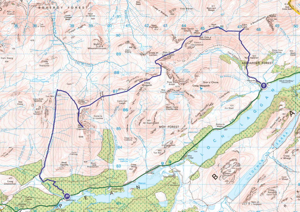
Creag Meagaidh circuit is a round of munros that will take in 3 summits. But if you look at the map then there are another 2 very close by. Of course, if you were to do all 5, then you’d certainly save yourself a bit of altitude by doing them all in one day. Main issue is, if you do them in the same day the start and finish point will be 13 Km apart. Not exactly want you want after completing 5 munros.
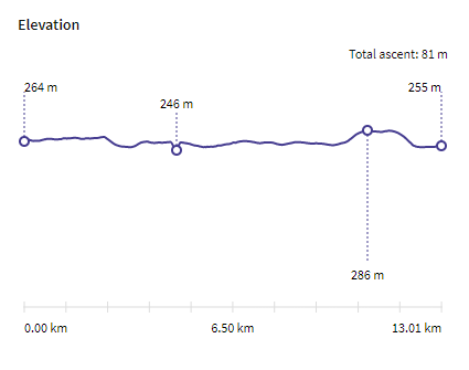
On the plus side, the start and finish points do make for an ideal cycle. There is a main road that you’d use to join both points together (now I’m assuming you’re not hiking with a friend who has also taken a car – if so, then park a car at either end, job done). What I did was to drive to the end point, offload the bike, chain it to the nearest non movable item and get back into the car to head to the start. The road itself is for the most part fairly level and also fairly wide, so you shouldn’t have issues with lorries or buses etc passing you too closely.
Also, over that 13 Km of road, you only ascend 81 m, so after a long day hiking you don’t need to worry about your legs being too sore and unable to cycle.
This review is part of a list of hikes that can be done with a bike, check out here for dozens more munros that can be done with the aid of a bike.
So what hills are involved?
- Carn Liath (Creag Meagaidh)
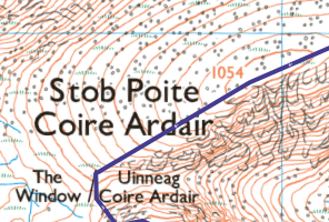
- Stob Poite Coire Ardair
- Creag Meagaidh
- Beinn a’ Chaorainn (Glen Spean)
- Beinn Teallach (I didn’t do this – but you can if you have the time/energy)
The above is the order I completed them in. Now you could do this walk-in reverse, but if you do then you are really going to have to complete them all in order to reach the end. You could bail out without doing the last – but it’s not so simple. Anyway, if you start where I did, then you can easily miss out the last one (Beinn Teallach). Which is exactly what I did as time wasn’t on my side, and neither were my legs! No point in rushing the last part of an enjoyable day. Over the years I’ve been hiking when I rush a hill then afterwards, I do feel like I’ve not enjoyed myself as much. If you need to, enjoy where you get to and then come back for the remainder another day. Doing 4 out of 5, means I can now consider the last one for a winter day as one summit during winter is often enough.
Should you do the 4, as shown in the map, the hike is over 26 Km with an ascent of 1455 m. It’s not a small walk, but a very rewarding one should you choose to do it. Not to mention the cycle back finish point is a whopping 9m lower than the cycle start 👍
Overview
- Height – 1006m, 1053/1054(???)m, 1130m and 1052m (915m for the one I missed out).
- Total ascent: 1455m
- My Time – 12 hours
- Distance – 26.4 Km
- Season completed – Summer
- Difficulty – 3 / 10
- Weather – clear skies, little wind. Warm enough to be pleasant at all levels.
- Just want to see the photos to get a feel for the hike – click here
- Route Map
Let’s get walking
With a route that will take a walker, not going at any great speed around 12 hours to complete, you’re going to want to start early enough. Also be aware of the time if you do intend to cycle back, as in make sure you have lights or be back at your bike before dusk. Last thing you want is to need to cycle in the dark or near dark.
You’ll start of on a perfectly good path, no really need to think about where you’re going. Follow the path through some trees and keep on going. Up until you reach around 400m, its simple, then there will be a fork. You want to head up and to the right. this will take you all the way to the top of Carn Liath. Now if the weather was really poor you could be forgiven for missing this peak. It’s really nothing special and once you reach just short of 1000m, heading to the summit point does then require a small amount of doubling back on yourself. The top area is slightly rocky, but very walkable. On the whole the ground is firm and pleasant for hiking.
Get Carn Liath out of the way and everything onwards is all great. I had brilliant weather and could see exactly what was ahead of me.
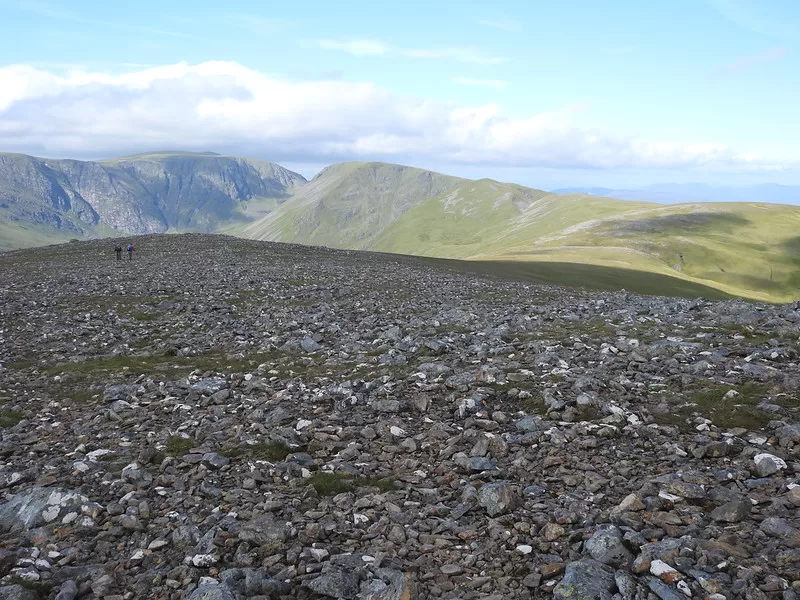
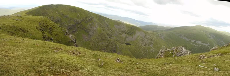
As can be seen above, the route west is pretty smooth and green. The ground has minimal boulders and rocks, so take your time and enjoy it. You will drop down to around 920m, then slowly gain height back until you reach 1054m.
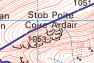
What gives – OS Maps? Different heights.
Every now and then you spot a mistake or a discrepancy in OS maps. Nothing major, but depending on the view/scale of the map, sometimes Stob Poite Coire Ardair is 1053m, then other scales it’s 1054m! Which is correct 🤷♂️📏⛰️
Windy – yet not
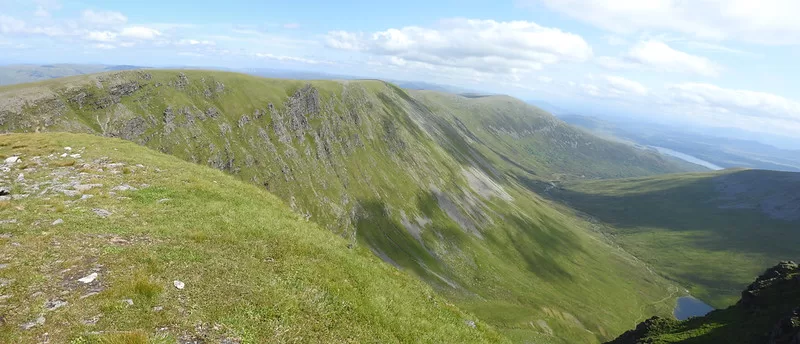
From the top of Stob Poite Coire Ardair, the views are amazing. Overlooking the lochan below to the south and to the north you have a great expanse of rolling hills. It won’t take long to descend to ‘The Window’ which in a narrow gap where if there is any sort of wind, due to the shape of the glen and coire will provide some seriously strong gusts of wind! You can see if from the maps, it’s an almost perfect funnel, which does again provide some magnificent views down the glen.
You will have dropped to around 950m for this part, only to go right back up to around 1080m, at which point it levels off. 1.5Km later you’ll be at summit number 3 – Creag Meagaidh. As ever on this route the path is clear and obvious, the ground is firm and shouldn’t give any issues at all. Zero bog factor here.
Route less clear
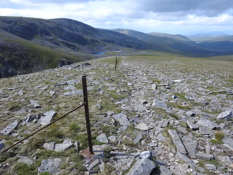
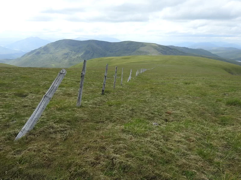
From here – the route is not as obvious. For myself, the weather was great so really no issue, but if you didn’t have the views then you can’t rely on a path as such for a guide. The ground is fine, as it has been the entire walk and as you come down off Creag Meagaidh you will see an old fence (marked on OS maps) which is as good a guide as any. It’s old wooden posts that are slowly rotting away. As seen below, along with summit number 4 (Beinn a’ Chaorainn) in the distance.
The terrain changes little, so enjoy it, take your time and slowly descend to around 825m. This will lead you to the bealach, which I guess is roughly just over 2Km from the previous summit.
From here, follow the ridge all the way up to 1052m which curves slightly to your left as you go up. It is a gradual increase.
Danger
If it’s still in place, you will be reminded that the hills are not always safe. There was a small memorial near the summit of Beinn a’ Chaorainn for someone that died in Feb 2018 (Jim Stalker). While I had perfect weather conditions, if you can’t see where you are going or the weather turns bad, always be prepared.
Summit 4 – which way now?
OK, so you’ve done 4, legs are getting a little tired. Time is ticking on to get back to the bike. Three options.
- Head south from the summit, without the need for a path, head to the bike in the most direct route possible.
- Head north from the summit, don’t drop quite as far as fast as the south route. Save the knees and Beinn Teallach.
- Head north from the summit, don’t drop quite as far as fast as the south route. Save the knees and decide you’ve had enough for the day. Take the gradual path back to the bike.
I chose the last option. the thought of dropping 700m quickly wasn’t really what my knees were after, and I was also still tempted to do the last summit. In the end after I reached the decision point about doing the last one or not, I had a seat and a snack, checked the time and energy levels were not enough to make it enjoyable. So I headed down between the two munros along the route marked as a path on the map – but it’s a bit of a stretch to call it that.
Keep following the stream and you’ll be fine, sometimes you’ll be on a visible path, other times you are just stomping through the heather and long grass.
Bike time
You’ll be glad to reach your bike, I’m sure. Other than get on your bike and enjoy the pretty much smooth section back along with some great freewheeling sections. That’s it ☀👍🗻
Route Map