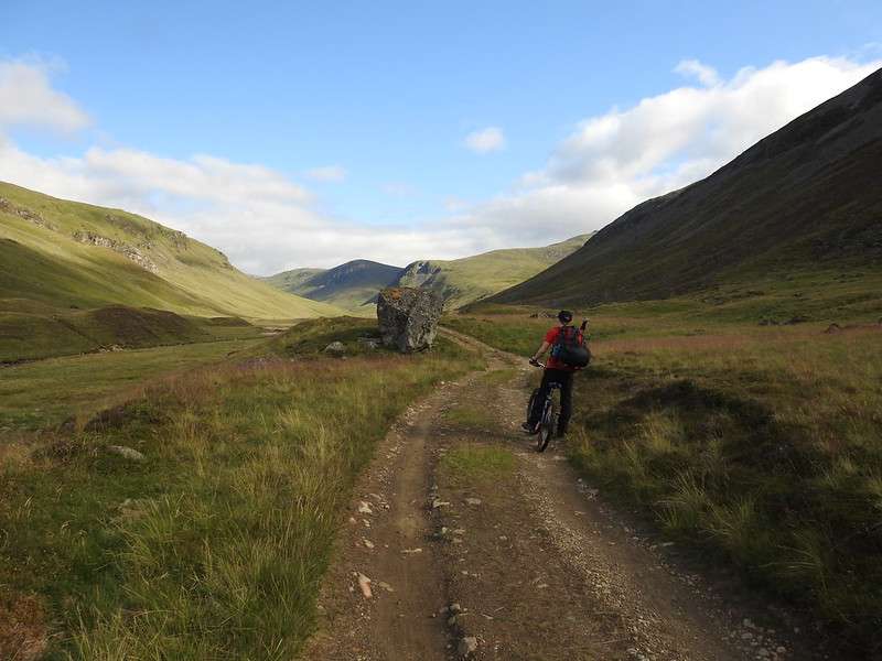
So many hills can be accessed with the aid of a bike. Doing so really helps and means that the worst part of any hill walk is much simpler. That worst part, for myself is always the hike down and back to my car, particularly the lower sections. You’ve done the best part, reached the summit and now you are only trekking back to your car – what better way to end it than to free wheel for several kilometres!
Disclaimer!
I’m not a biker or a keen cyclist. My bike generally only gets used for those handful of days each year where I take it up a hill. This should give an indication of the level of ability required for these cycle/walks!
The List – The ones I’ve done first
I’ve done a few hikes with my bike and as such I’ll list them first and as I create reviews of each one I’ll link them here as well.
The ones that I’ve marked as suitable for a cycle are in the next section. I’ll add to this as I go through the map of hills looking for suitable routes.
- Hill Name (munro count if completed)
- Beinn Bhuidhe (1)
- Glas Tulaichean, Carn an Righ and An Socach (3)
- Beinn Lutharn Mhor and Carn Bhac (2)
- Mount Keen (1)
- Creag Meagaidh circuit ( 4, maybe 5 if fit/quick)
- Carn an Fhidhleir and An Sgarsoch (2)
- Meall Chuaich (1)
- Lurg Mhor and Bidein a’Choire Sheasgaich (2)
- Glen Strathfarrar Munros circuit (4)
- Beinn a’Bhuird, Beinn a’Chaorainn & Beinn Bhreac (Cairngorms) (3)
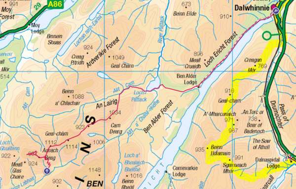
- Beinn Bheiol and Ben Alder (2)
- Càrn Dearg, Geal Charn, Aonach Beag, Beinn Eibhinn (4)
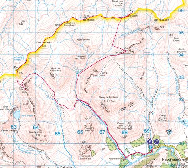
- Càrn Dearg, Càrn Sgulain and A’Chailleach (3)
- All the ones I’ve not done – but think might be good…
Beinn Bhuidhe
Doing this with a bike can make it a very quick munro as well as an extremely enjoyable one. I’d put this very close to my top munro to do with a bike.
Read the review here
Or jump straight to the photos here
Or head to the OS Map here
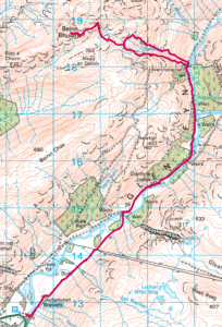
Glas Tulaichean, Carn an Righ and An Socach (wild camp 2, part 1)
Done as my second time wild camping. The bike aids greatly to carry that extra weight over the miles of nearly flat tracks.
Review can be read here.
Check the map on OS
Photos of the walk here.
Beinn Iutharn Mhor and Carn Bhac (wild camp 2, part 2)
Day 2 of my second time wild camping.
Oh man, was I glad to get on the bike for the last leg. It’s wonderful.
Review can be read here.
Route map on OS
Check out the photos from the day.
Mount Keen
OK, so I’ve not done this with a bike, but walked it instead. But in doing so I see that with a bike it would be brilliant.
Review can be read here.
Route map on OS here
Check out the photos here.
Alternative route I’ve not done via Glen Tanar – OS Map
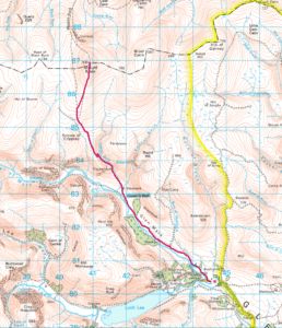
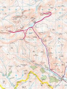
Creag Meagaidh circuit + 1 or 2
Read the route description and tips here, plus check out the route map on OS or the photos.
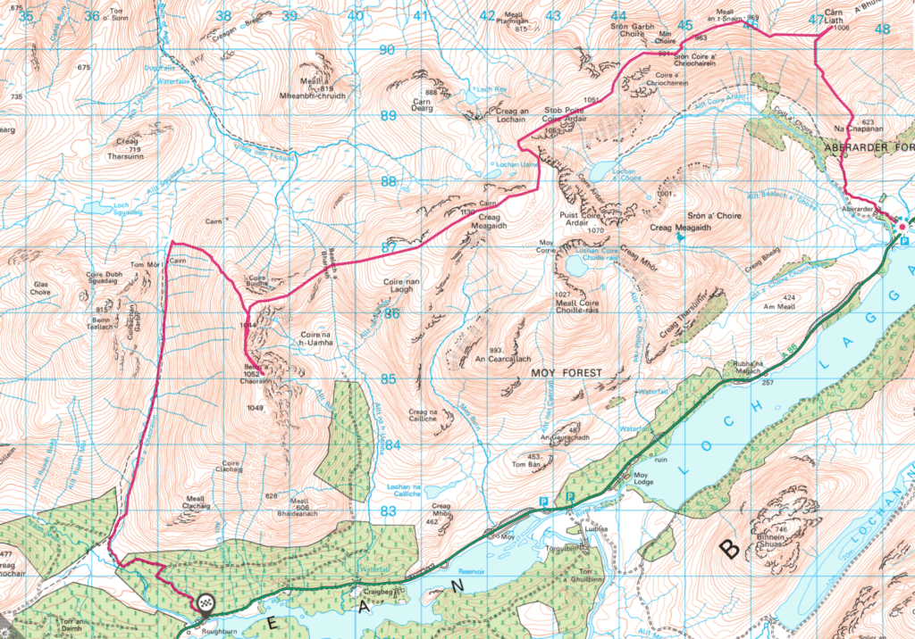
Carn an Fhidhleir and An Sgarsoch
Review coming soon, check out the route map on OS or the photos in the mean time.
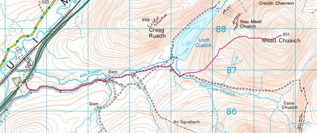
Meall Chuaich
Review coming soon, check out the route map on OS or the photos in the mean time.
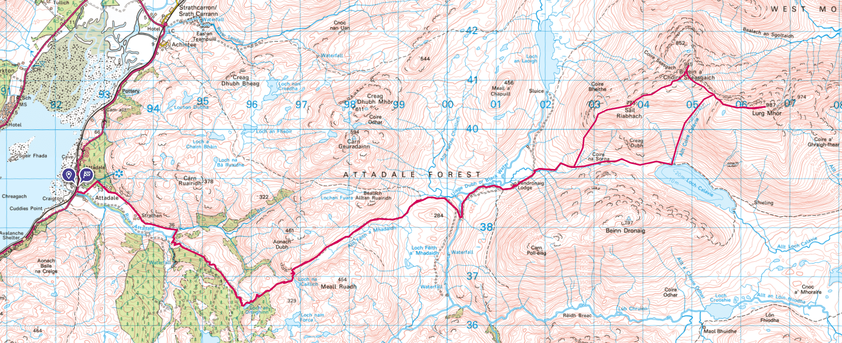
Lurg Mhor and Bidein a’Choire Sheasgaich
Review coming soon, check out the route map on OS or the photos in the mean time.
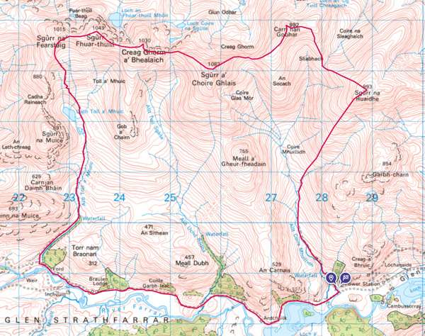
Glen Strathfarrar Munros circuit
Review coming soon, check out the route map on OS or the photos in the mean time.
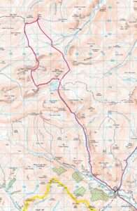
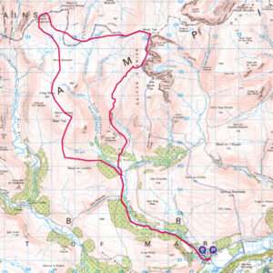
Beinn a’Bhuird, Beinn a’Chaorainn & Beinn Bhreac (Cairngorms)
Review coming soon, check out the route map on OS (half route map, only plots to the top – you come back same way so double it) or the photos in the mean time.
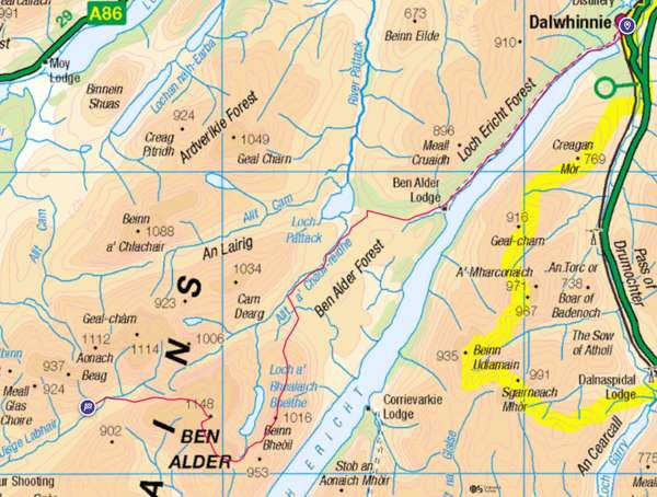
Beinn Bheoil and Ben Alder (wild camp 1, part 1)
Review coming soon, check out the route map on OS or the photos in the mean time.
Càrn Dearg, Geal Charn, Aonach Beag, Beinn Eibhinn (wild camp 1, part 2)
Review coming soon, check out the route map on OS or the photos in the mean time.
Càrn Dearg, Càrn Sgulain and A’Chailleach
Review coming soon, check out the route map on OS or the photos in the mean time.
The List – The ones I’ve yet to do
- Càrn A’Chlamain – Map here – Looks like around 9 km of flat to start with.
- Maoile Lunndaidh, Sgùrr Chòinnich and Sgùrr a’Chaorachain. I’m planning this as a wild cycle and camp. There are quite a few in this area with the same potential flat lead in. Check the OS map out here
- Slioch – Map here – Looks like a 5 Km start of with minimal elevation.
- Stob Ghabhar and Stob a’Choire Odhair – OS Map route here.
- Beinn Mhanach – Map here – Another at roughly 9 Km flattish starter section.
- South Glen Shiel Ridge 7 – Map here
- Sgòr na h-Ulaidh – Map here
- Gulvain, near Kinlocheil – Map here
- Beinn a’Chlachair, Geal Chàrn and Creag Pitridh – Map here
- Beinn Na Lap, Càrn Dearg, Sgòr Gaibhre – Two ways in, with the train here or without here
- Seana Bhràigh – From Strath Oykel Map here
- Seana Bhràigh – From Inverleal Map here (this looks much less suitable than the previous map for Seana Bhràigh if using a bike).