- Height – 1045 m highest point
- My Time – 11 hours (24.9km)
- Season completed – Summer
- Difficulty – 5 / 10
- Weather – Started sunny, cloud level then fell below the summits before lifting a little.
- Just want to see the photos to get a feel for the hike – click here
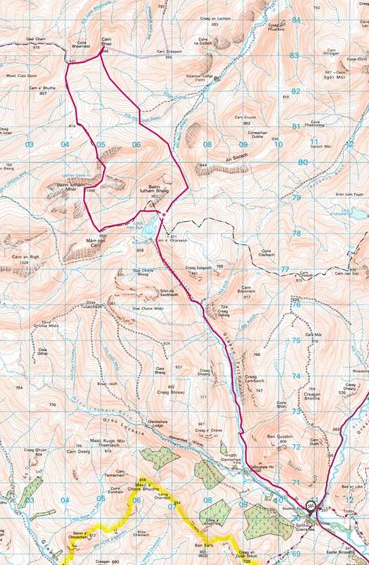
- Route Map
- Part one – day one
Sunrise
Waking up and taking in sunrise while being at 800 m is a great feeling. Hard work, but most certainly worth it. The night was a slightly windy one and the ground we’d pitched our tents on although more than solid enough, it was amazing that you could feel it move/vibrate at times with the wind.
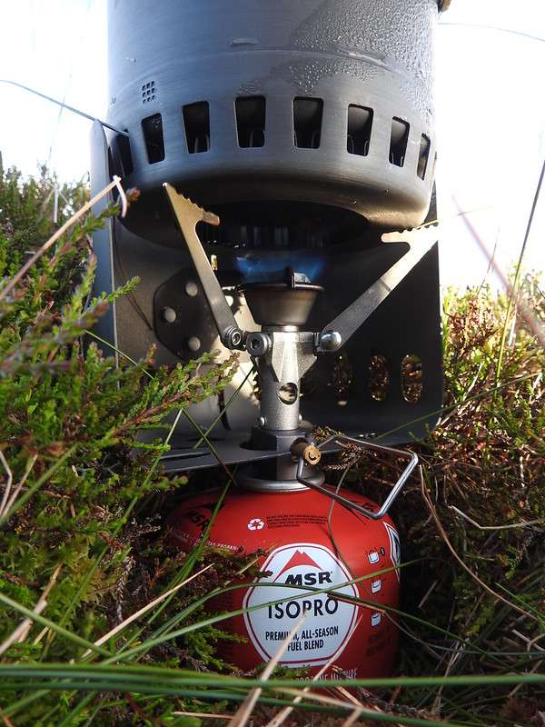
Breakfast time, so it’s a case of getting some water from the loch, giving it a good boil, then time to make up some breakfast porridge and a hot drink.
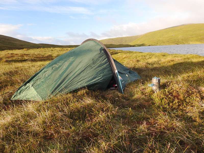
The sun was up, the cloud base was very high and we’d just filled up on some breakfast. All was looking good.
Unlike the previous day, the route we planned to take on day 2 wasn’t straight forward. To get to the first summit, wasn’t difficult but after inorder to get to the second munro needed some careful navigation. More on that shortly.
Route but no path
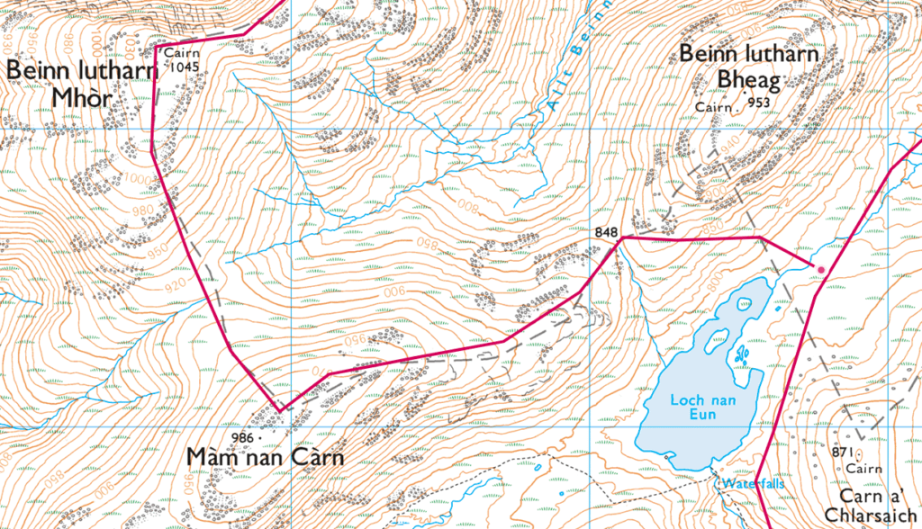
Due to our tent position it didn’t make sense to walk around the hill until we reached the path. You can clearly see from the previous day that there is a good path, but that is on the west side of the hill, and we where hitting it from the east.
The ground, although no obvious path is solid underfoot and fairly comfortable for walking on. It’s a mixture of short grass and heather. You can head up from the loch and then follow the hill a it gradually rises. As long as you are gaining altitude you can either hit the 900-920 m mark and then cut across to Beinn Lutharn Mhòr or keep on going till you get to the summit of Màm nan Carn (which is 986 m), then head down a bit and on-wards to Beinn Lutharn Mhòr.
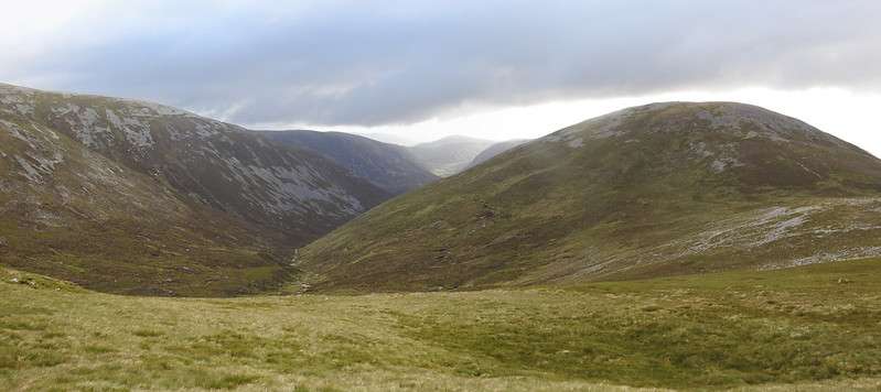
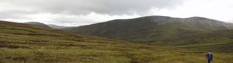
As can be seen the day was clouding over slightly and the above gives a pretty good indication of the conditions on the ground. It wasn’t boggy, nor rocky, but a fairly good surface for walking.
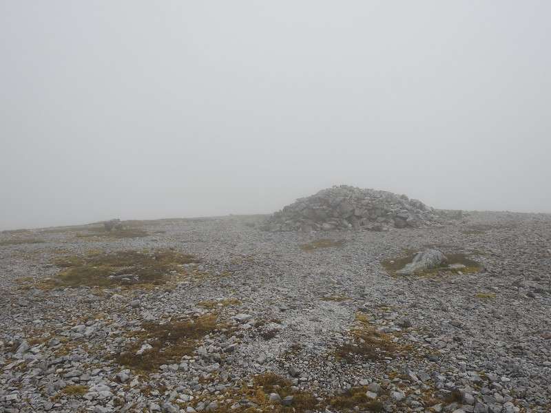
Once on the main approach you join the path to the summit. The ground conditions change and it becomes much more stony underfoot. But thankfully it is not a boulder-field, more small rocks and gravel. The cloud had now fallen below the summit level which is always rubbish but that’s just what happens now and then.
Where to now?
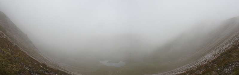
With the low cloud and the unknown exact location of the exit to come down on to reach our next summit some careful navigation was required.
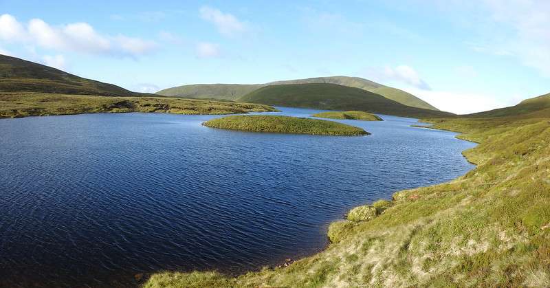
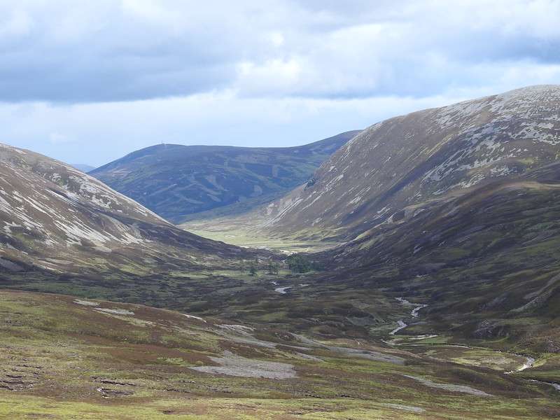
Headed almost directly east from the summit and with that you don’t want to be dropping any altitude as it’s fairly flat for 1 Km as you follow the curve. On your left you should be able to see Lochan Uaine. We could just make it out through the clouds.
Once far enough round the curve you’ll need to find a suitable place to drop down. Without being able to see the bottom and by the time you reach approximately OS Grid Ref: NO 05119 79914 you’re going to have to start looking for a route down. It’s fairly steep so you will have to zig zag a bit plus their is a fair amount of scree so do be careful when going down. If you leave it to far before heading down then the slope gets very very steep.
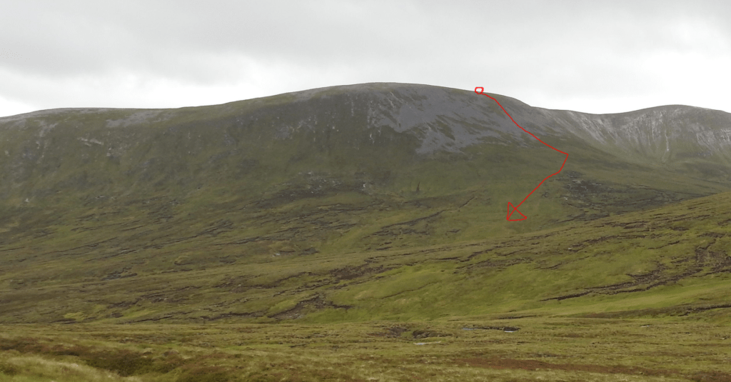
In the above photo Beinn Lutharn Mhòr is on the far right and I’ve marked where we came down with the red line.
Rough conditions
The cloud had now lifted so we could see where we were going and where we had come from. The conditions on the ground were now hard going. The ground is scarred with small and not so small peat banks that have been eroded away. It’s soft underfoot and the grass can be long and other areas boggy, to top it off the views are far from spectacular. It can feel hard going at times, especially as you’re legs may well be tired from the previous day effort. Best way forward it to try and follow the very vague ridge that will lead you to the middle of Carn a’ Bhutha and Carn Bhac.
Once you do start to climb again, it’s not until you are almost at the top that the ground firms up a little bit more and walking is less of a struggle.
Almost there
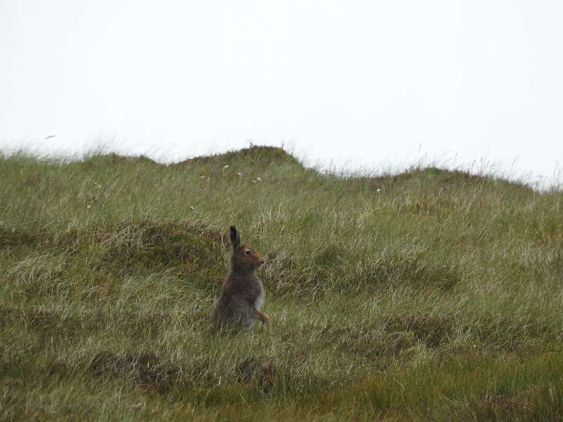
We did see a number of hares, but like most hills they are extremely barren when it comes to wildlife.
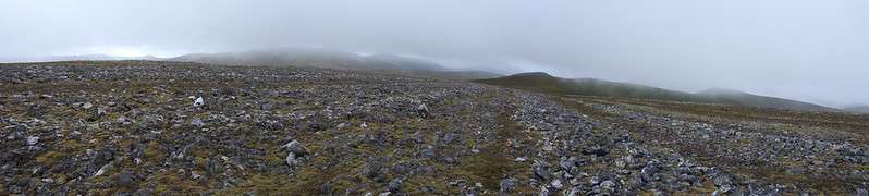
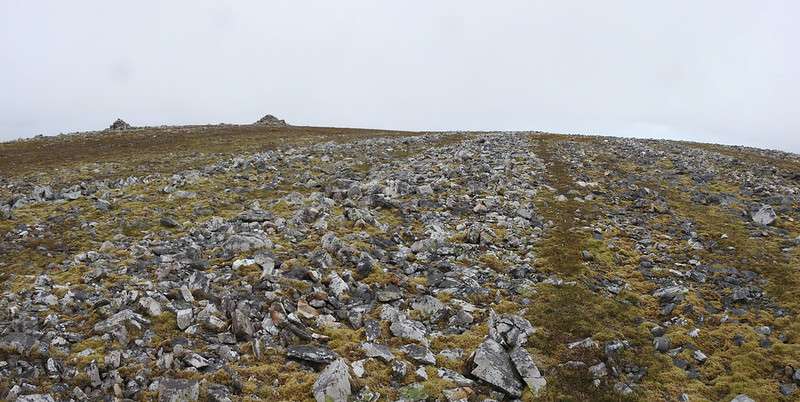
Now that we’ve reached the mid point at roughly 920 m the cloud was starting to come in again 😢 Now we are heading roughly east and around 1 Km from the summit. The way is clear, but it does get very rocky once again underfoot. But unusual the rocks are formed in vague lines, it’s very curious.
Still it means that you can walk on a path in between the rocks, which is rather handy.
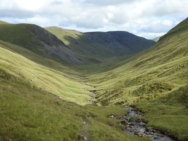
Heading back
Just south of the summit are a range of grouse butts and as such there is a path or sorts so the going is much better heading down. You keep going until you drop to around 650 m and carry on going between An Socach and Beinn lutharn Bheag.
There isn’t really any path as such, so it’s another section that is hard going. Walking though deep heather, crossing various ruts and holes, but that’s all part of exploring.
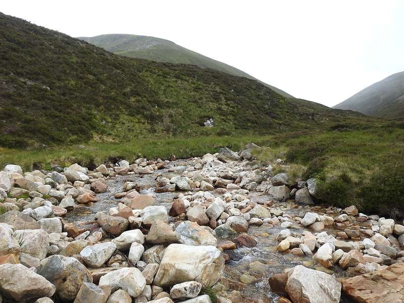
You’ll have to cross a stream at some point, but unless there has been loads of rain that shouldn’t be an issue, but it may mean you have to deviate up until you are able to cross it safely. The below is the stream, run off from between Beinn lutharn Bheag and Beinn lutharn Mhòr.
Homeward leg
Back at the tents stop for some fuel then pack them up and head towards the bikes. The extra weight on your back plus the fact that you’ve walked so far in two days is hard going. As I’ve said elsewhere in this site I’m not a super fit person as most of my time is spent behind a desk! So this is stretching my limits but most definitely do-able by most people.
Still the best bit is yet to come. You don’t have far to go with that extra weight and they you are at your bike. Sheer bliss. You’ve got 8-9 Km of ever so slight downhill. The weather had improved and whizzing down a good track on a warm day is brilliant
Route Map
You can read general advice and planning tips etc on wild camping here