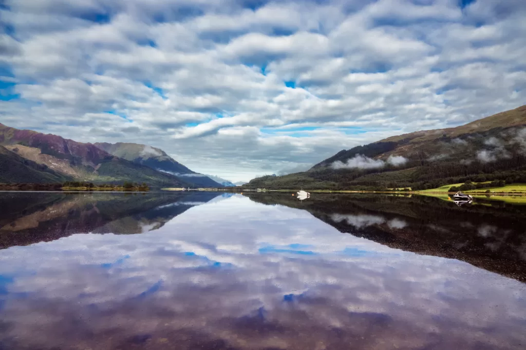
Weather in Scotland, sometimes you get super lucky and you couldn’t ask for more. Not to hot, not to cold, clear skies or at least the clouds way above summit level as some cloud cover is ideal to stop us Scottish folk turning into lobsters! As you can see from the above photo, the weather was brilliant!
This was for the completion of the munro on the western side of Aonach Eagoch Ridge. The following is part two when I completed the munros on either side of the ridge, without actually doing the ridge.
- Height – 967m
- Total ascent: 952m
- My Time – 7 hours
- Distance – 7.5 Km
- Season completed – Summer
- Difficulty – 4 / 10
- Weather – clear skies, virtually no wind, see intro. Almost perfect day for the weather.
- Just want to see the photos to get a feel for the hike – click here
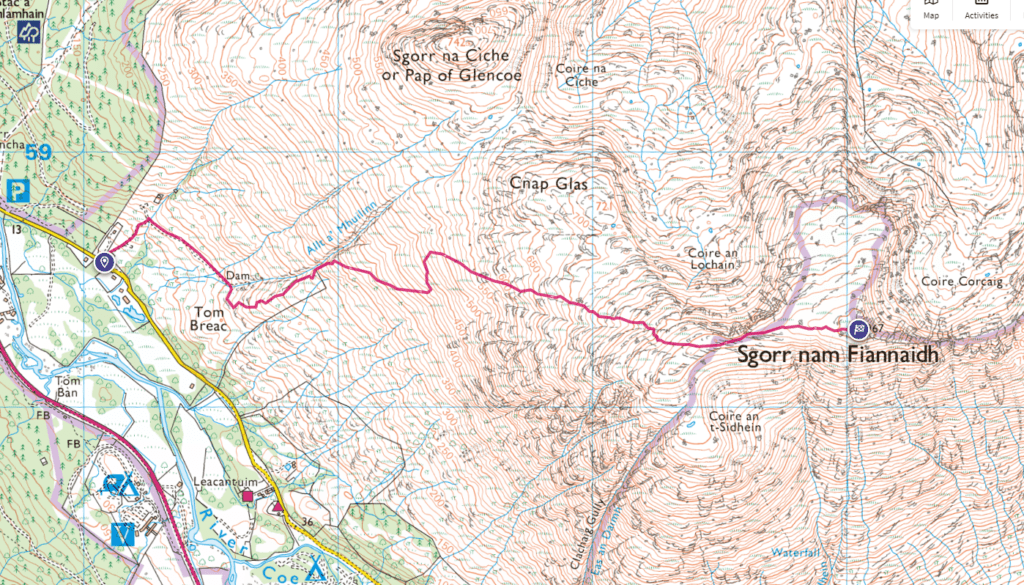
- Route Map
- Part 1 – Meall Dearg
Parking
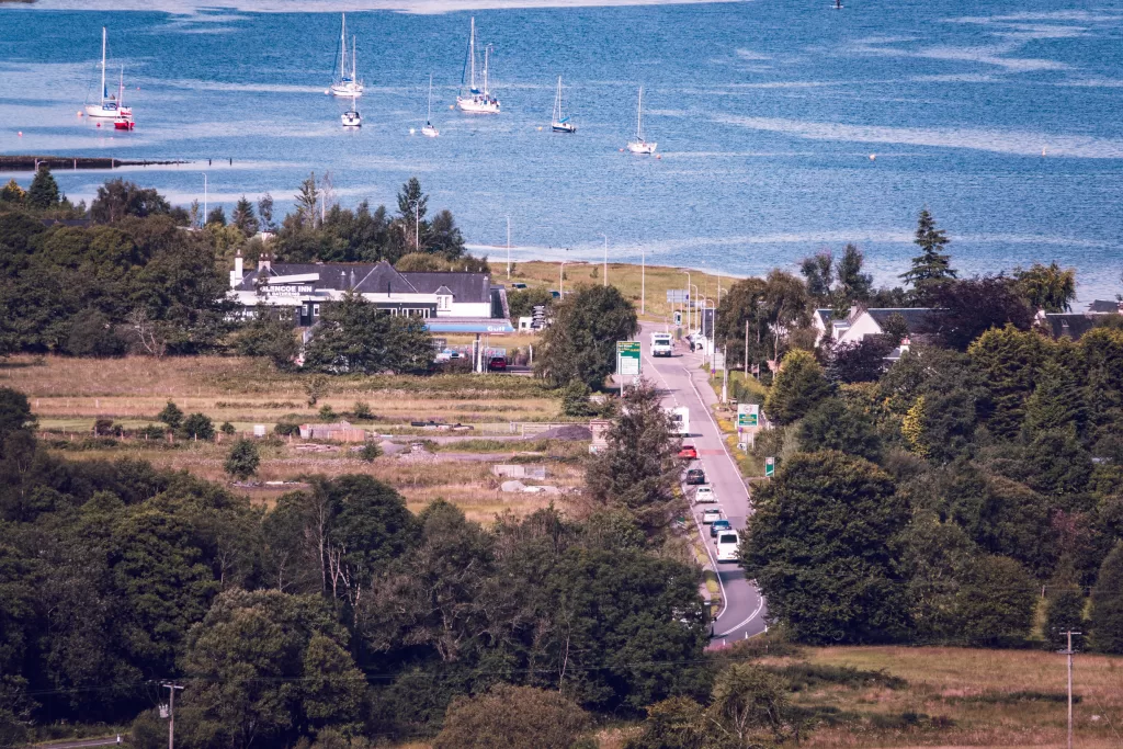
First and most importantly – parking. Whether you are doing the Pap of Glencoe or the ridge you will park in the same place. There is one large-ish car park (area of ground for parking, not a smooth tarred car park). Looking at a couple of different maps I wasn’t 100% sure as I thought there may have been two, but just the one area for parking.
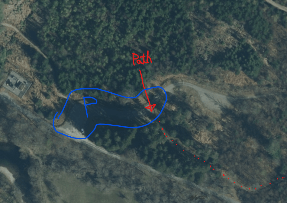
From the car park you don’t head to the road, but part way up in the car park you will find a path. this takes you along the road, without going onto the road. Fairly soon you’ll see the point to start heading up. Main thing to note is that when there is a split in the path you should head right. There are a number of splits and given I went right at each one, I guess all the rest are for different paths that head up the Pap of Glencoe.
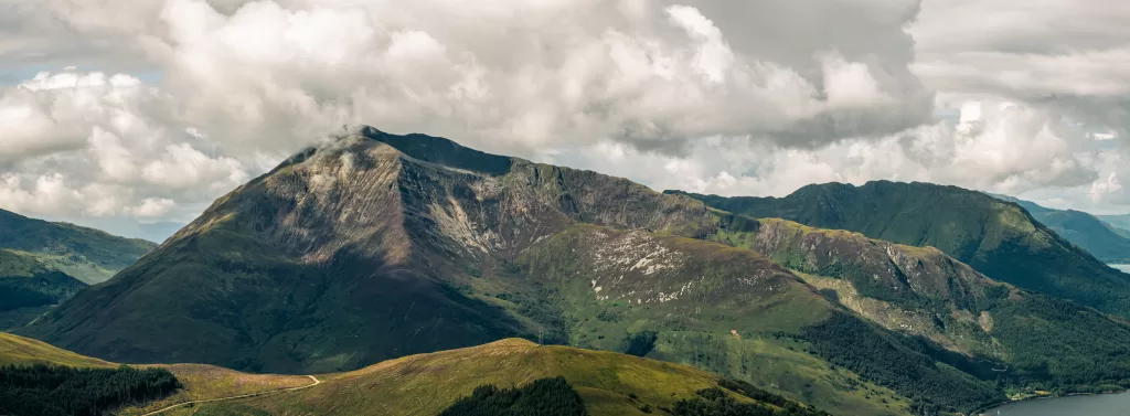
Pap of Glencoe
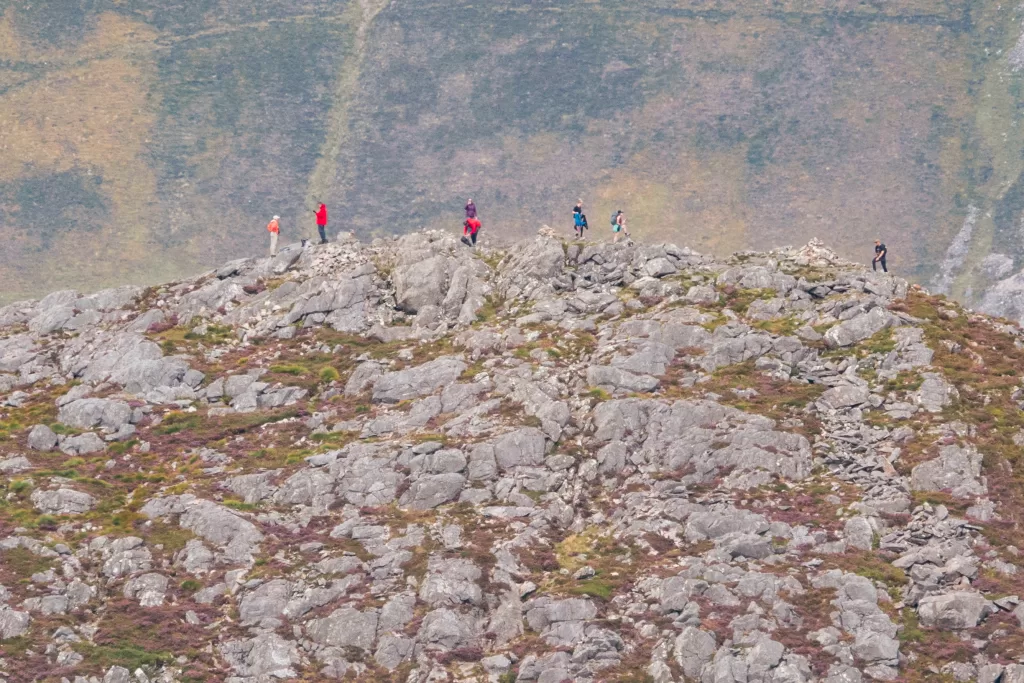
I was very surprised at how busy it was in comparison to the munro summit! Check out a couple of photos I took of the Pap. Loads of people and I was pretty much the only one heading up the munro. All seemed very odd as such a little difference in height. The Pap is 742m in height whereas Sgor Nam Fiannaidh is 967m. If anything the last section of the Pap of Glencoe looked fairly steep and a little bit of a scramble, and the munro was a simple walk for the most part with a minorly steep part at probably 800-850m.
Keep Right
The path to the top of Sgor Nam Fiannaidh is obvious for 90% of the way, but as part of the the route also can take you to the Pap of Glencoe you may end up on the wrong route. Especially so if you can’t see the hill due clouds/mist etc. Best thing to do is when you reach a fork in the path – head right. For example early along path there was a small sign that said ‘hard’ (left)/’easy’ (right) route. It didn’t say to where and was a bit of a handmade sign on a bit of wood. My guess is that again it was a sign for the Pap. Either way head right.
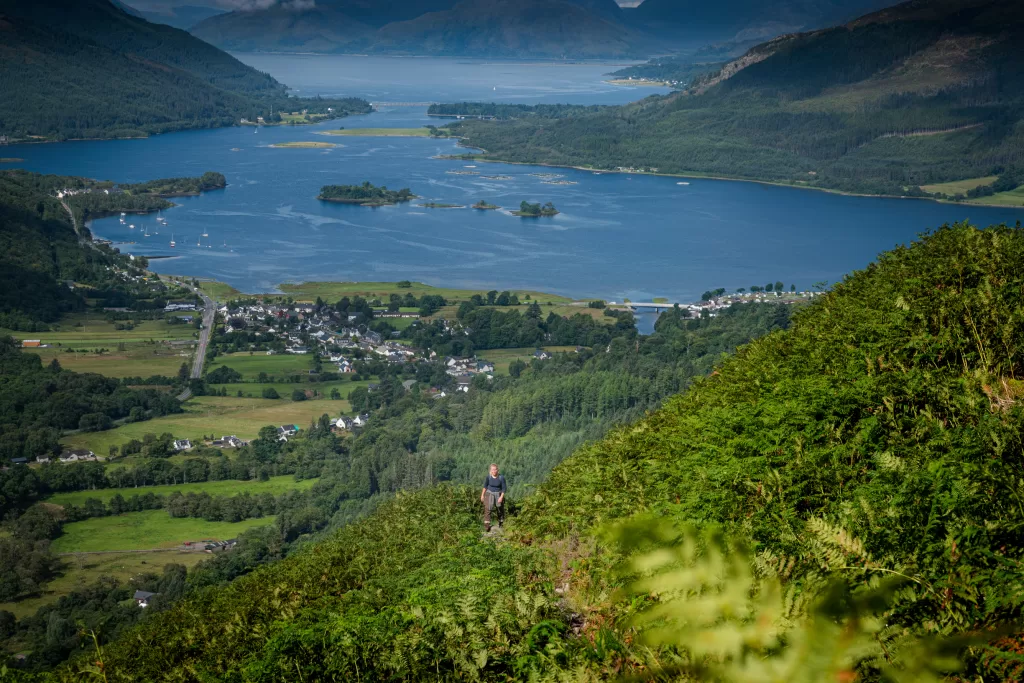
Glencoe/Loch leven
The views of Glencoe and of the loch are outstanding. Now I did get a good day, but the views are awesome. Just look at the above and the below shots. Beautiful!
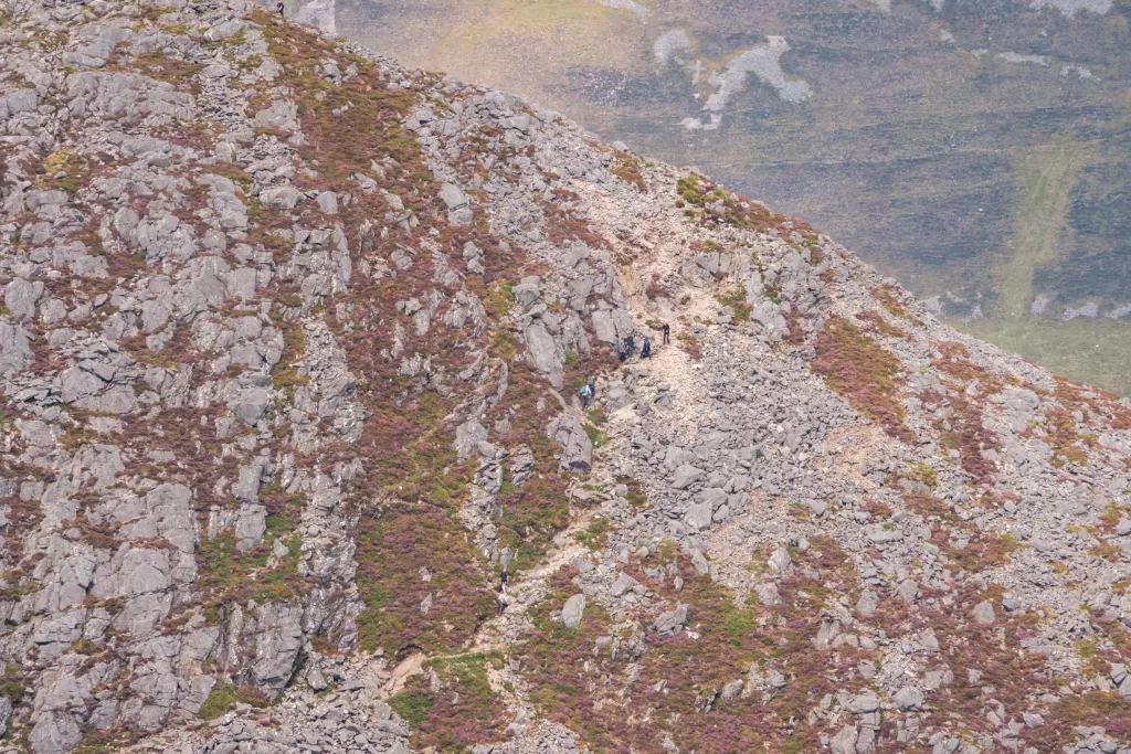
Path – where?
There was only one part of the hike where the path disappeared and it wasn’t clear what the best route was. The terrain turns to rocks and boulders, and if you look closely you can kind of make out different paths. Perhaps as it’s not obvious for a single route as many people will have made numerous smaller fainter paths. It doesn’t really matter as long as you keep going up and heading in easterly direction. This area is around 750m+ and it is fairly wide and if your careful, nothing to worry about. Before you know it you’ll be approaching the plateau near the top.
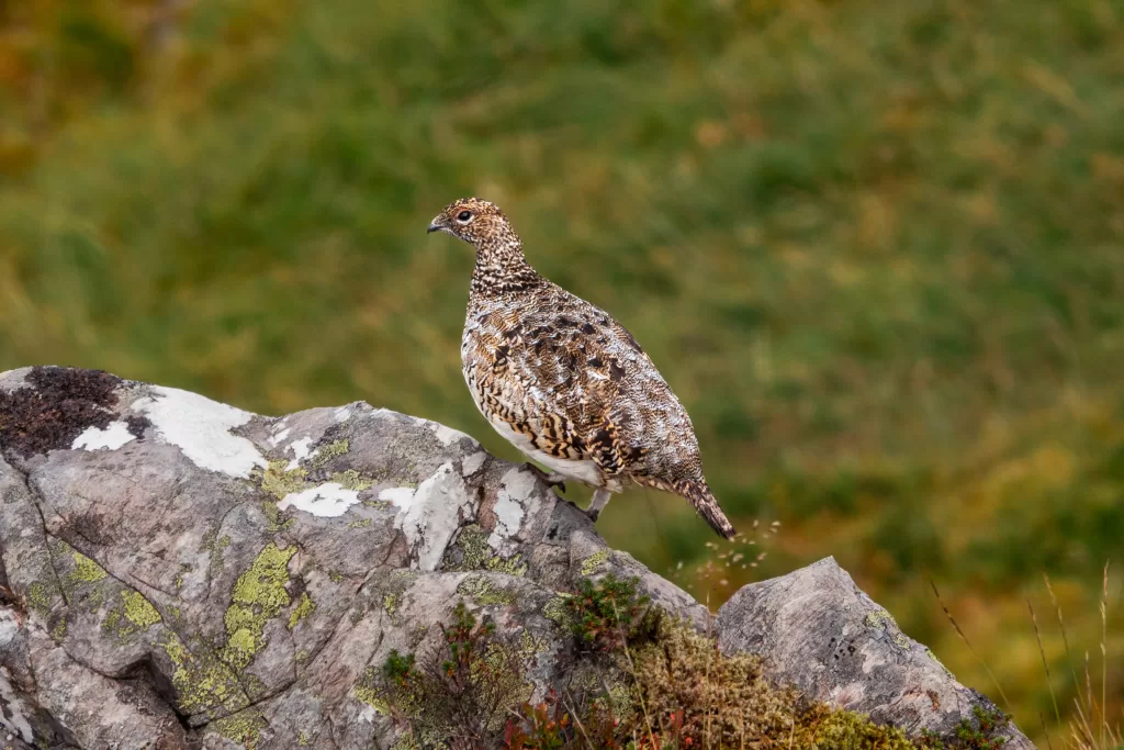
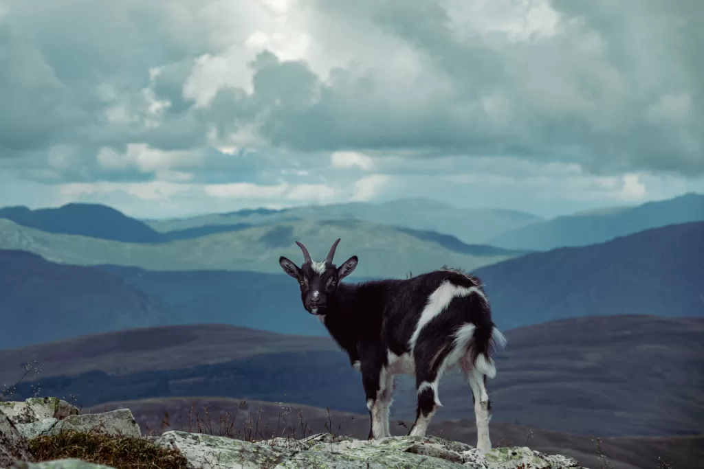
Goats
Wildlife can be in short supply when hiking. Which is definitely a tad depressing. So when I reached around 900m, end up being pleasantly surprised to see some goats! Don’t think I’ve ever come across any goats before while hiking, and certainly none at the summit of a munro! Possibly a dozen of them, just doing what they do. Did make for some interesting photos along Glen Coe
(note the village is Glencoe and the Glen is called Glen Coe).
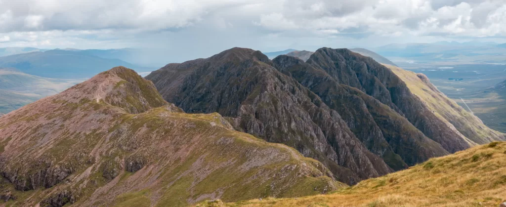
After that, it’s a very short and flat walk to the summit point where you can see the ridge. Stop for some food, then back down the way you came. Before you do go down, you could go further along the ridge without hitting the difficult portions if you wanted a different viewpoint before returning. You can see from the below shot that you can walk roughly another 1Km without issue.
On the way back, it’s probably the viewpoint when looking down a slope, but I find on sections such as the relatively pathless portion to be much clearer. Much less likely to take a wrong turn, the paths from the birds eye view seem obvious and you wonder how you missed them in the first place!
Route Map
All in, this hike was one of my more pleasing and pleasant hikes. Not too steep, not too hot, not too busy, not too cloudy, and views were pretty amazing 👍🙂🌲