- Height – 948 m
- My Time – 6 hours
- Season completed – Summer
- Difficulty – 4 / 10
- Weather – Beautiful day. Clouds were way up high, and few and far between. Sun was a little too hot…
- Just want to see the photos to get a feel for the hike – click here
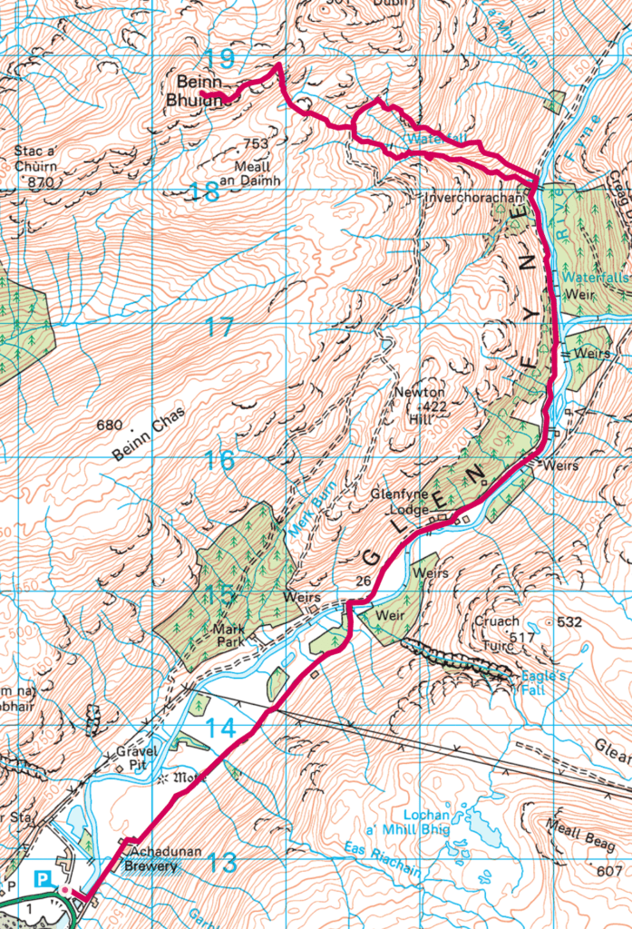
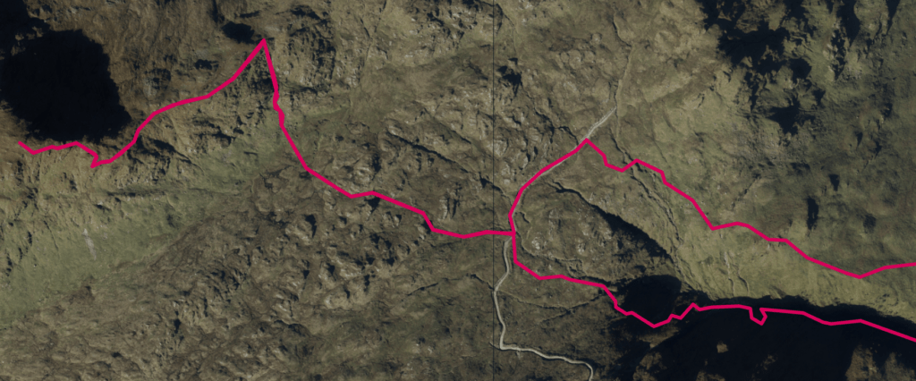
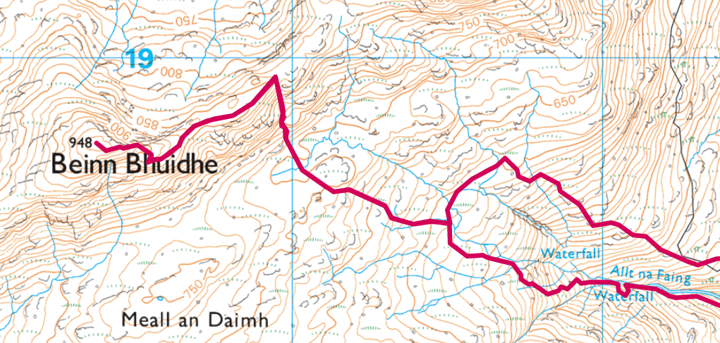
- Route Map
Starting Point
No issue with this hill when it comes to parking. There is a fairly large car park at OS Grid Ref: NN 19327 12771. Even if that was full, there is still spaces to park nearby. I didn’t start particularly early with this hill and had no problem.
Bike
Bhuidhe is certainly one that you should do with a bike. Not doing it with a bike would seem bonkers considering the length of flat track that is available to you. It has roughly a 6km flat section in (and of course back out) and taking into account the distance required to actually hike is brilliant.
Should you see sense and take your bike, after about 4km in you’ll be met by a gate and a sign telling you to go no further (on your bike)! Really not sure why they ask this. I’d guess it’s that inconsiderate people in the past have left the gate open so it’s locked now. There is access for walkers and no issues for you to keep walking, just means a minor inconvenience to lift the bike over. You choose what to do, but whatever you do be considerate. If the gate isn’t locked – make sure you shut it.
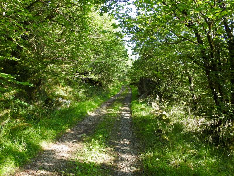
As you can see above the track is in pretty good shape, smooth enough to be an enjoyable cycle. This is taken after the previously mentioned gate.
Right way and the wrong way up
Beinn Bhuidhe is a cracking munro, maybe it was the weather, maybe it was the micro brewery at the bottom, or maybe it was the sheer wealth of wildlife that I met on the way up the hill. Certainly one to complete.
When it comes to walks that involve a circular portion, often doing it either clockwise or anticlockwise can make a significant different to the enjoyment of the walk. Bhuidhe is one of these hills. Going up one part will be better than coming down and the other side will be more suitable for going down than up.
So which side and why?
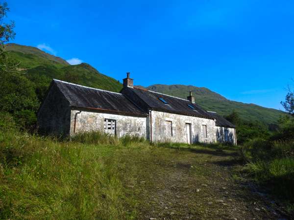
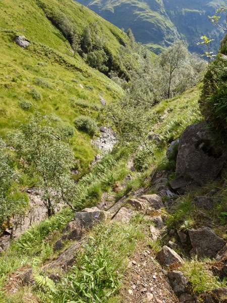
If you’ve already jumped to the map section you’ll see that once you reach the end of the flat section you have a choice to make. Not long after the abandoned building you go through another gate and then you can park your bike up somewhere. Do not cross the bridge. Make sure you take the south side of the route going up the waterfall – why? Well if you don’t then you’ll miss out on this!
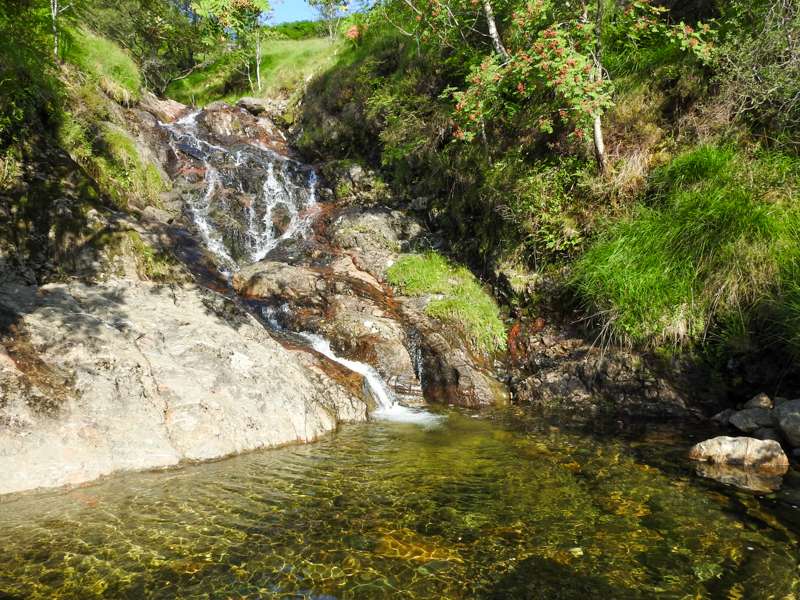
Good number of beautiful pools on the way up, and a good number of small waterfalls. The path on the other side has no view of these as it’s too far away.
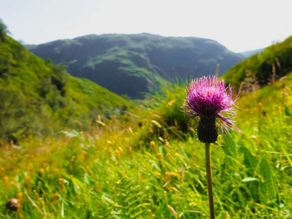
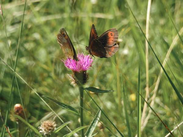
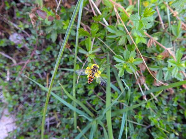
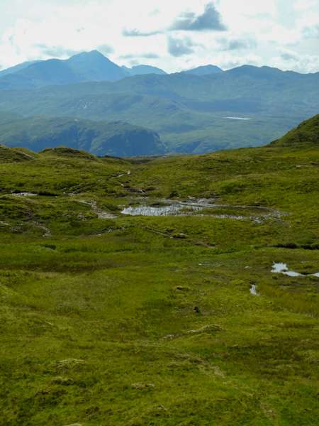
On a warm spring or summers day, their is going to be a good variety of wildlife. Not just bugs, bees and butterflies, but lots of plants as well.
Now normally you see next to nothing doing a munro, but this sheltered area, with a clean fresh stream flowing through is a wee oasis for wildlife.
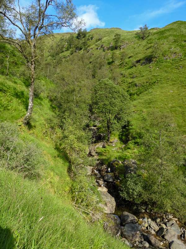
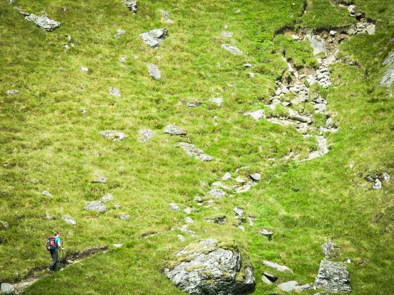
The reason I’d say not to come down this side and go up it instead, is that for myself I found a couple of sections where care is needed and a couple of parts where you’ll need your hands to aid you along. Nothing too hard, but if doing this coming down, it would be just a bit harder. Whereas the path on the right of the stream (north side), which is to far away to see from my photos is nothing but bracken up to your head height.
On the flip side, coming down will be when you’re legs are slightly tired (not too much with this walk as it’s fairly short) and if you’ve set your sights on sitting down for a cool beer and a little snack then the quicker you get back the better.
Fyne Ales
Fyne Ales have a brewery and a takeaway where you can chill out and even if your the nominated driver you can at least purchase some food (to eat in) and drinks to take away. I took with me more than a few different bottles and cans – definitely worth it! https://www.fyneales.com/visit/
At the moment it says it’s open from 10 am till 6 pm. So plenty time to pop in. If only every munro had one of these at the bottom!
Back to the walk…
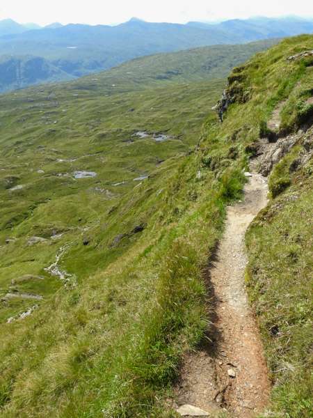
So you’ve taken the route suggested up the side and for the most part it’s not a big path, but clear enough. It’s a grassy and sometimes gravel path, no bogs on this section. One part that can be a little steep with a drop into the stream/gorge, once passed it’s a clear route on up to where you will cross a substantial hill track. This is around the 600 m mark. Oddly OS maps does NOT show this! But if you use the aerial view then you can see it clearly.
You can see here on the left the path is very narrow and you have to climb up maybe 1.5 – 2 meters from the path below. Plenty of rocks to step on, but a slight difficulty part for some. (you could back track and go up and around this if you really needed to) Once passed you keep heading up and the path widens with no more ‘climbing’ sections.
600 Meters
At around 600 m you will hit the track and as you can see, depending on where exactly you pop up from the path you may then need to make a small deviation along the track. At roughly OS Grid Ref: NN 21502 18467 you’ll see a path heading up the hill that leaves the hill track. Follow this
From here you’ll find the going gets softer and in places boggy. Although most of the time there is a path that will get you through the worst bits. In comparison to many other hills – this wetter section is some small that you probably won’t even remember it.
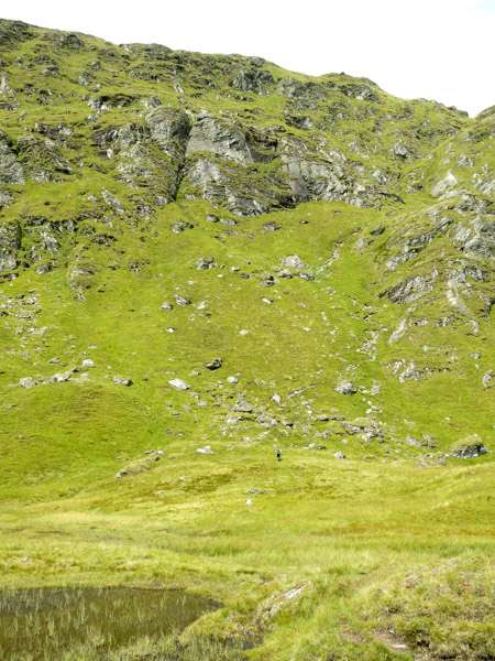
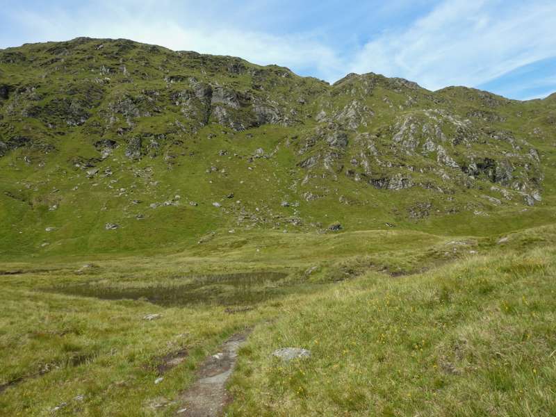
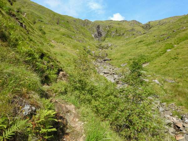
You should be able to tell from the photos that’s this is a short section and the way up although from afar may look a bit daunting, ends up being quite good. As seen in the last of the above photos there is some loose stony parts to the path, so be careful.
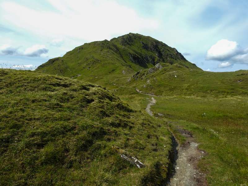
Plateau
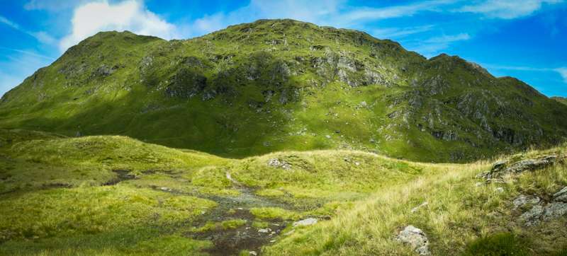
Now you’ll be at a height of around 840 m with only a short distance to go. From here your views of the surrounding hills is only getting better. You’ll be able to see the likes of Beinn Ime to the south, Ben Oss to the north east, and soon enough you can look past Dalmally and see the several from that location once you reach the summit itself.
The path is well worn and sometimes fairly close to the edge. If it was really windy, I’m not sure I’d be keen on being here. As it was, there was only the smallest of breezes.
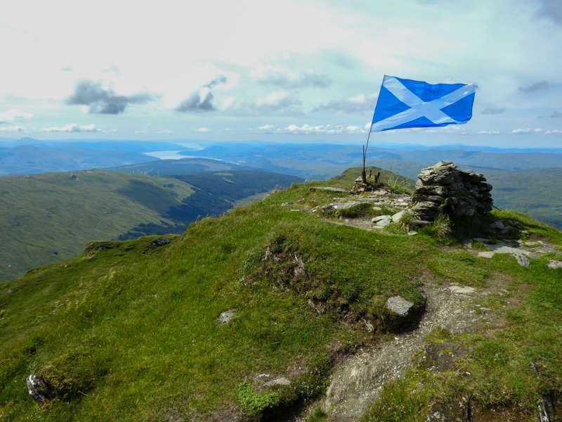
The Summit
You can stride along now, on the hard and flat path to the top. Only a slight climb towards the end. Once there, should you need shelter then there is a straight wall – which is better than nothing. But as you can see from the photo it will only give limited protection.
Route Down
You have a choice here, in that you don’t need to come down the exact way you came up and I’m not referring to the waterfall section. You can carry on once you get to the point where you reached the plateau and instead of going down you can carry on in a NE direction, then curve down so that you hit the route for the northern side of the waterfall section straight on. I didn’t do this.
Chose to head down the same path I came up, then when I reached the track, headed up a short amount before starting my descent. Couldn’t see a path as such, but it’s pretty much a case of shortly after crossing the stream you can start to head down. There are points where you can see where people have walked. When I did it the bracken was head height in places and everything was very green, so any path wouldn’t be obvious.
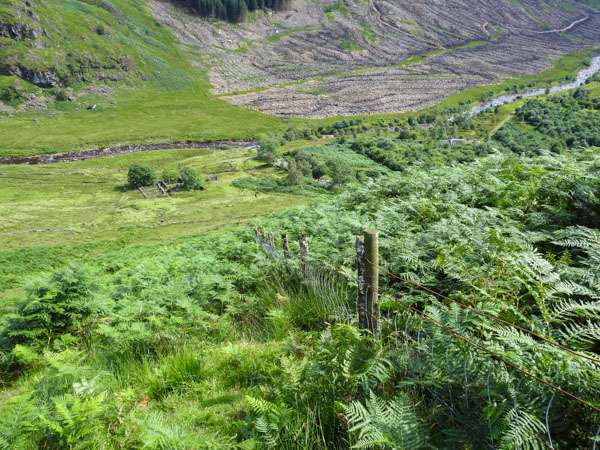
Using this side you don’t get close enough to see the waterfalls or pools, but it is simpler to get down and easier on the knees. So ploughing through bracken for the sake of your knees is worth it 😎
The ground was solid enough and on perhaps one bit where is was minorly steep there is a fence beside you should you wish to use it for an aid.
Route
https://osmaps.ordnancesurvey.co.uk/route/3473425/Beinn-Bhuidhe-via-Glen-Fyne