- Height – 1155m (ascent 977m)
- My Time – 9 hours (start point was the camping area)
- Season completed – Summer
- Difficulty – 4 / 10
- Weather – Pretty good. High levels of cloud, not too hot or too cold. Wind was also on the lower side.
- Just want to see the photos to get a feel for the hike – click here
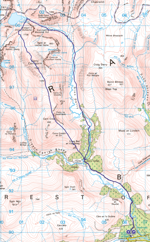
- Route Map
- Wild camping starting point – guide
Starting Point
As this is a wild camp, it’s got two starting points. One for where to park the car and the other for where to camp and then start the actual hike from.
Braemar
In order to get to the start you have to pass through Braemar. If time allows, make time to stop here. Grab some food, take a wonder around etc. It’s a great wee place. Lots of tourist shops, but they have much more than the tacky crap you see in the likes of airports or Edinburgh’s Royal Mile! Not to mention there are good few wee places for food.
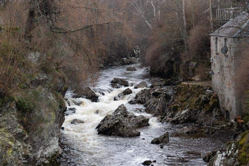
Anyway back to the start. There is a very well catered for car park around 15 minutes west of Braemar (6-7 miles). The Linn of Dee Car park has plenty of spaces as well as toilets, as such it has a charge, but it’s well worth it.
From starting point 1, to starting point 2!
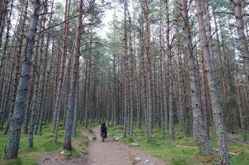
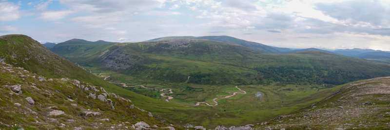
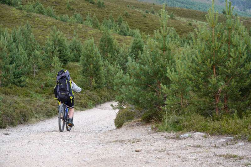
The path away from the car park, much like the car park is well maintained (another reason to pay for the car park) and will give a fairly smooth bike ride which will lead you from around 376 m to a height of around 424 m by the time you reach Derry Lodge.
Friendly people
Must mention this, as the person we spoke to may not have thought about it, but it was one of the little highlights that my daughter remembered from our weekend. Something that just takes a few moments of someone’s time.
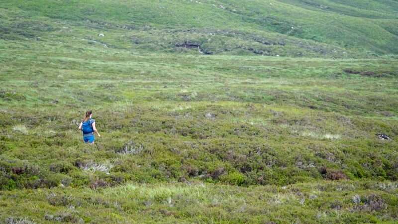
Right before the wee reached our campsite, we were taking a quick break. There was a lady who was out running stopped to speak to us. Well she was more speaking to my daughter, who thought this was cool as the runner had taken what appeared to be a genuine interest. So we were chatting away for a small time and then of she went, as did we. Discussing it a bit as we cycled on.
The lady had an unusual accent, I couldn’t place it and it was bugging me. One of those things, didn’t wish to ask, but afterwards wish had asked where she was from. Anyway she was gone and we were cycling… So that was it, or was it…
Skip forward to the next day, at the end of a long walk and who comes up behind. Yes the same lady. Very friendly, so she stopped again and started speaking to us. She was training to do some ultra-marathons up the west coast. Anyway – found out she was from Shetland.
So should this lady read this – thanks. It really boosted my daughters flagging energy. It’s the little things that count.
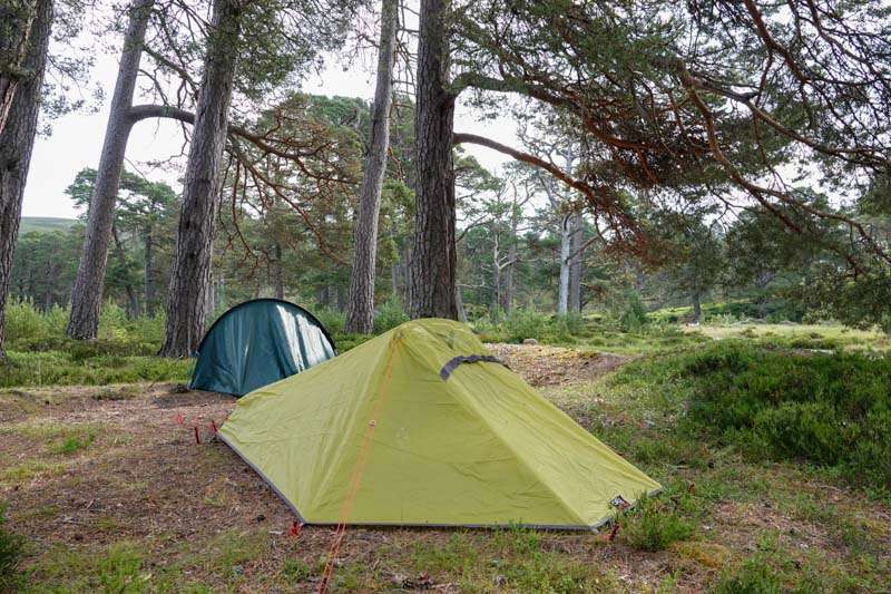
‘Camp’ site
Just over the bridge at Derry Lodge you’ll find a good flat area, not far from the river and sheltered with the trees. This may be considered a good and a bad thing! Midges and Clegs also like the shelter…
At one point the clegs got really bad and one managed to bite me through my jumper! Out came the Smidge – and away they went! Brilliant stuff. No midges today, but clegs are worse imo. Nasty blighters, the bite they give can leave a mark for a good number of weeks. Make sure to get your Smidge.
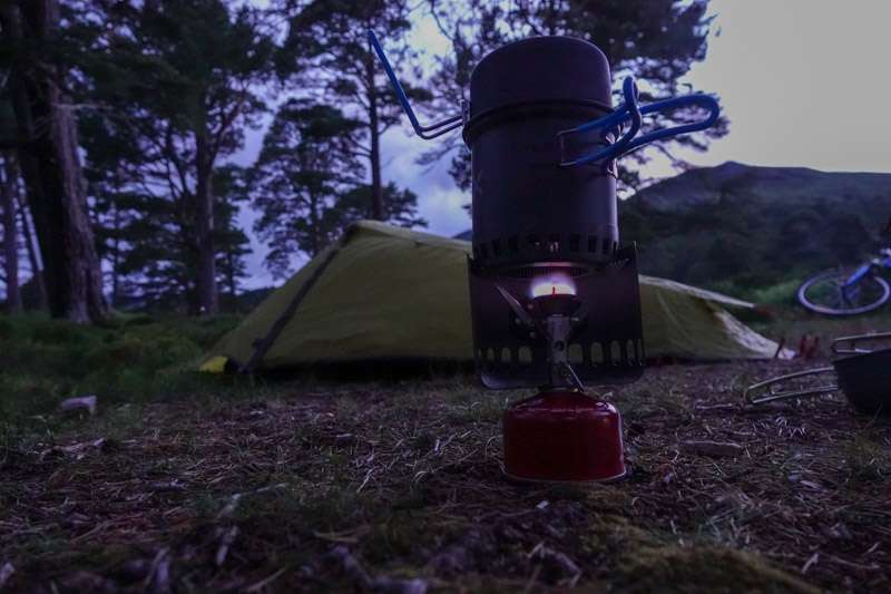
We get a good night’s rest, after some hot chocolate and late night snacks. If ever camping, items like sachets of porridge and hot chocolate are the best. Just add hot water – instant energy and in the case of porridge, long lasting energy.
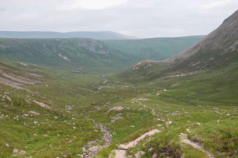
The Hike
The loop up and down (see route) is in the region of 11 Km from our camping spot and back again. so it’s not a massive hike. You can add in Beinn Mheadhoin if time and energy allows as it’s only around an extra 4 Km with a height gain of around 250 m. For us though by the time we reached where you’d choose to carry on or head down the energy levels were flagging.
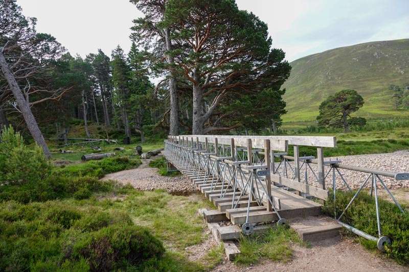
This bridge close to Derry Lodge is a rather annoying bridge if you have a bike! Not wide enough for your average mountain bikes handlebars to be straight and also the railing is higher than them as well. So you have to carefully wheelie the bike over….
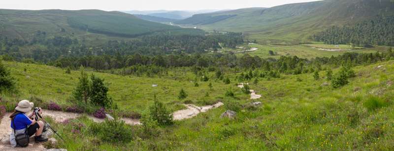
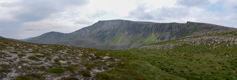
The hike itself is straightforward, and you soon gain enough height for some awesome views. The path is well worn so you can’t miss this either until you are much higher up and the land turns to a boulder field. One tiny section requires a bit of care, just east of Carn Crom the path gets very close to the edge. But if you are unsure then you’ll be able to take a slight deviation (for which you can see others have done on a slightly less worn path) to avoid it. By this point you’ll be at over 800 m.
The angle of ascent does lead to a couple of false summits, which if you aren’t looking at your map can be a bit annoying 🙂
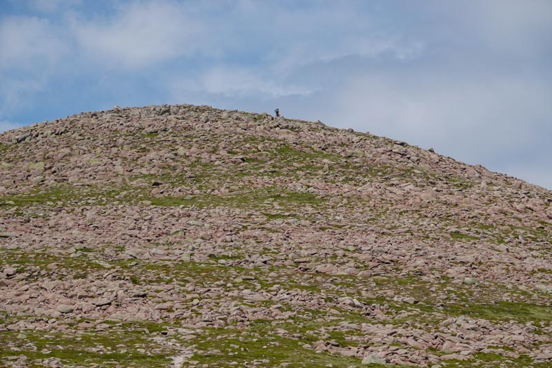
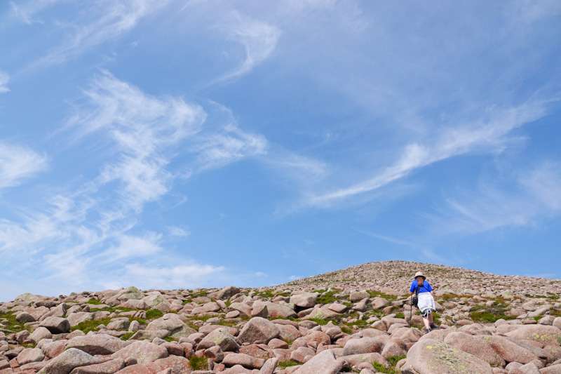
The boulders start to make up most of the ground from around the 1000 m mark. You can see from the images there is still a fair bit of greenery between them but you will be slowed down a bit by the boulders as you scramble over them.
Summit
The summit awaits at 1155 m. There’s a small cairn and enough larger boulders to get some shelter should it be windy.
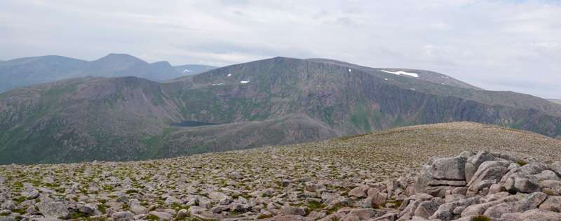
Now is the time to make a choice. You can head back the way you came which will save time – and be a tad boring. Or carry on and do a loop back via Glen Derry (with the option of Beinn Mheadhoin).
We took the option to loop via Glen Derry. As you drop off from the summit, there isn’t a direct path due to the boulders. So in bad weather navigation could be tricky without the aid of a compass/map. You also have the continual issue of the boulders making your progress slow as you head down.
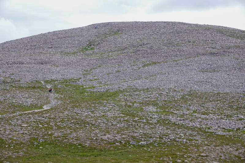
As you can see above there is a path coming down, but it’s very easy to miss and isn’t visible from the summit area. Knowing it’s there means that if you do miss it after dropping down a little then you can head across rather than down until you reach it. Being on it, will make progress much simpler.
Views
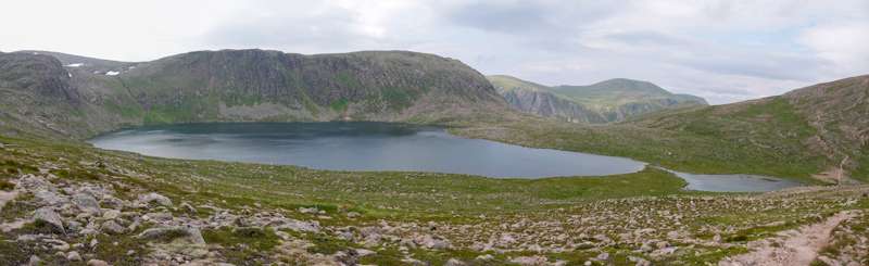
The above shots give a very small flavour of the views from the top (or close to the top). You can see so many other summits now that you’re in the heart of the cairngorm national park. The going underfoot is good the entire way (other than boulders). When you reach the loch shown in the above photo (Loch Etchachan – which if you’re looking for a high altitude camping spot would be ideal) you can make that choice as previously mentioned to carry on for another summit or return. The return route will take you passed the Hutchison Memorial Hut.
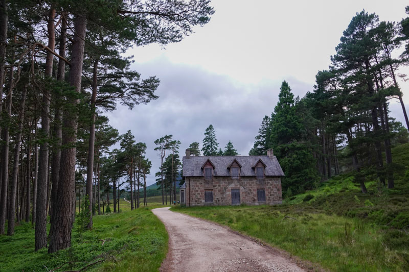
Hutchison Memorial Hut
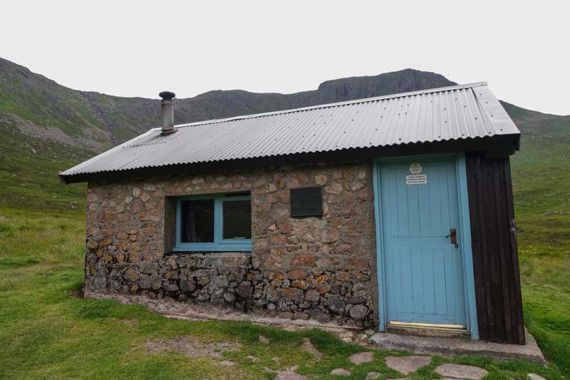
This is perhaps a reason to not head back the way you came when on the summit. Worth a visit, put your feet up for two minutes and grab a snack. Not like the weather was bad for us, but worth it anyway.
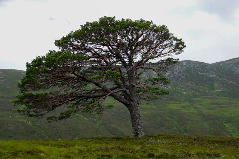
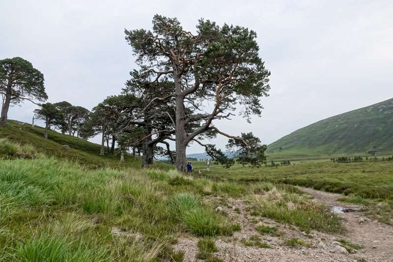
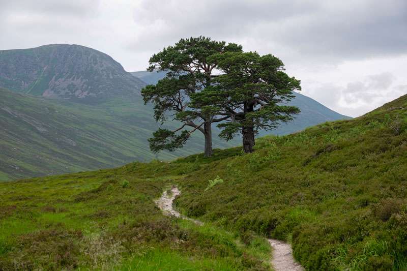
Scots Pine
Glen Derry is full of Scots pine trees and you can tell that they are doing their best to regenerate the forests of old. The route back is nothing special in terms of the path. It’s a simple and long path back, solid underfoot with a stream or two to cross – but again all fine. The trees and the reforestation do add that touch of special though. Can’t help but enjoy the shapes and form of these trees. Something unusual and majestic about them.
Not much more to add other than pack up the tents, enjoy the cycle (mainly freewheeling 😀 ) then back into the car.
Route