- Height – 927 M
- Total ascent: 914 m
- My Time – 8 hours (with kids – youngest was 5)
- Distance – 7.2 Km
- Season completed – Summer
- Difficulty – 4 / 10
- Weather – Starting with clouds near the summit that never completely lifted until we the day was completed! Dry-ish and little to no wind.
- Just want to see the photos to get a feel for the hike – click here
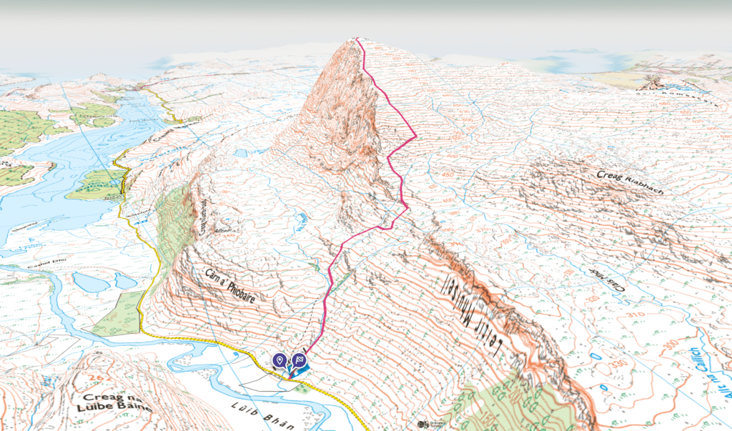
- Route Map
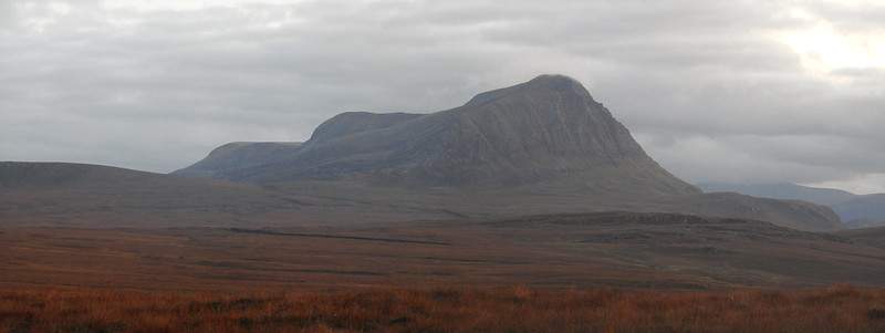
Ahhhh Ben Hope, the most northerly of munros. Must be a beautiful walk with such a name and status of the most northern summit. Unfortunately not! Reminds me of when you read of places such as Greenland that are actually the opposite.
Positive first
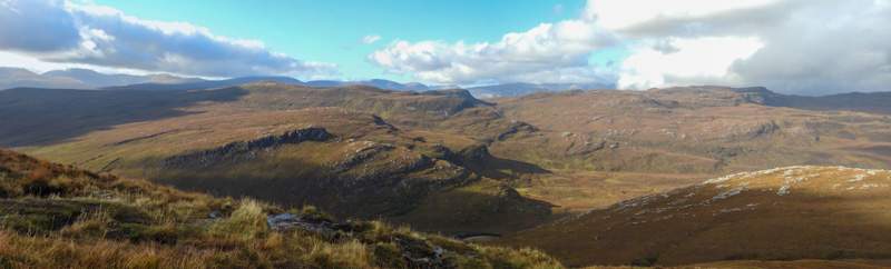
The scenery around the area is brilliant, and if the weather conditions were better then I’m sure the downside to the hike would have been well worth it. The clouds did clear at the end of the day, just to show us what we’d missed out on!
Start – not the start?
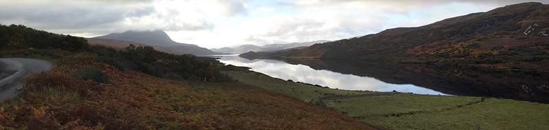
So obviously there is a starting point, but the journey to get to the starting point along the little B road is a start in itself. Having travelled from the north side, along Loch Hope, I’d highly recommend making time to take this part of the journey a little slower. It’s not that you can go fast on the road anyway, but I mean make time to get out and admire the scenery. I’d failed to do this, as this was a family hike and we were running a little late, so not much time to stop for photos.
Real start
There is a farm building and a fair about of off road parking space available, but this hill is a busy hill. By the time we go there sometime after 10 am, the area was fairly full of cars and the like already. You’ll find the start point at OS grid ref: NC 46199 47657. There are no facilities anywhere nearby and the closest village is Tongue which is around 17 miles away and it’s pretty small. There is Altnaharra (13 miles), but I guess unless you’re staying at it’s hotel, then there is nothing else there.
Path
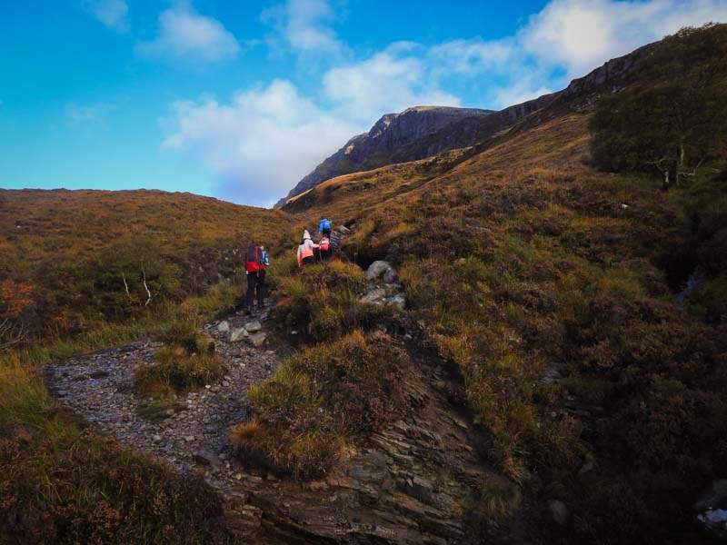
You will certainly not struggle to find the path. This must be a really popular hill, we did it mid Oct and as mentioned the parking area was full of cars/motorhomes (approx. 30 vehicles). As such the hill is scarred with the amount of footfall it gets.
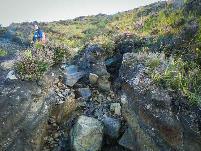
There is a stream coming down the hill and you start on its southern side. The OS maps have a path that crosses the stream at a very low level – you don’t actually do that! But don’t worry as mentioned the real path is very obvious.
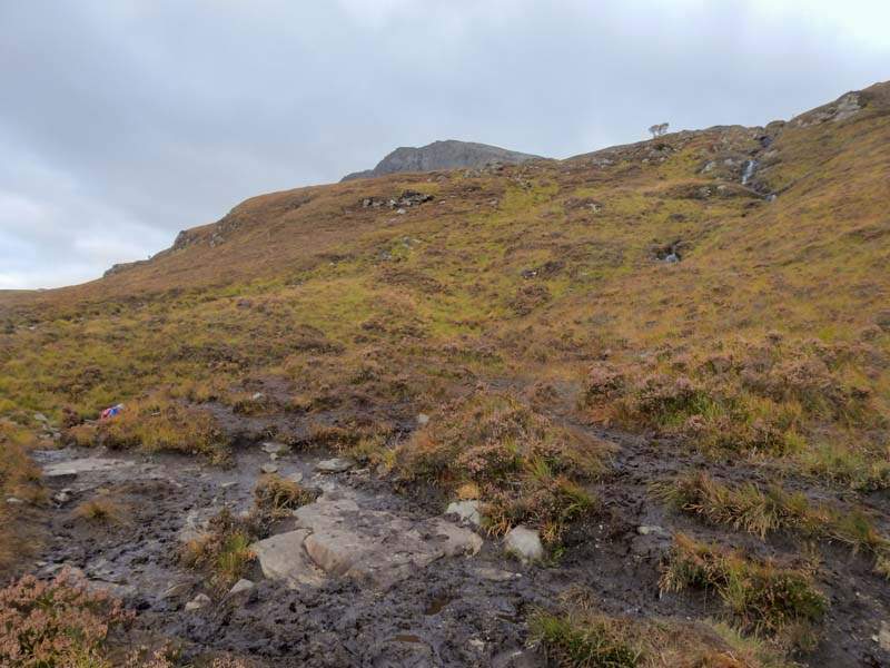
The initial portion is steep enough, worn out, muddy, a bit craggy. Not the most pleasant. Between 150 m and 400 m, the climb varies from levelled of terrain to having to climb up in-between craggy rocks. At no point though do you need to actually climb or scramble, it’s not that steep. We did have our 5 year old with us and he managed the whole walk just fine.
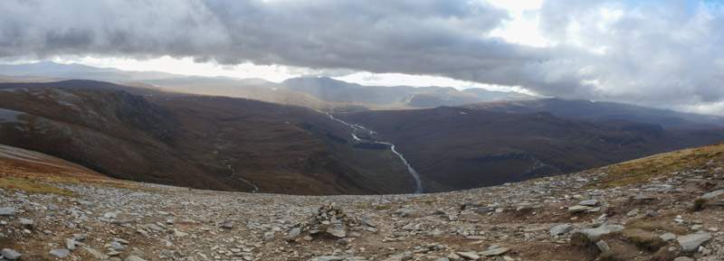
Strath More
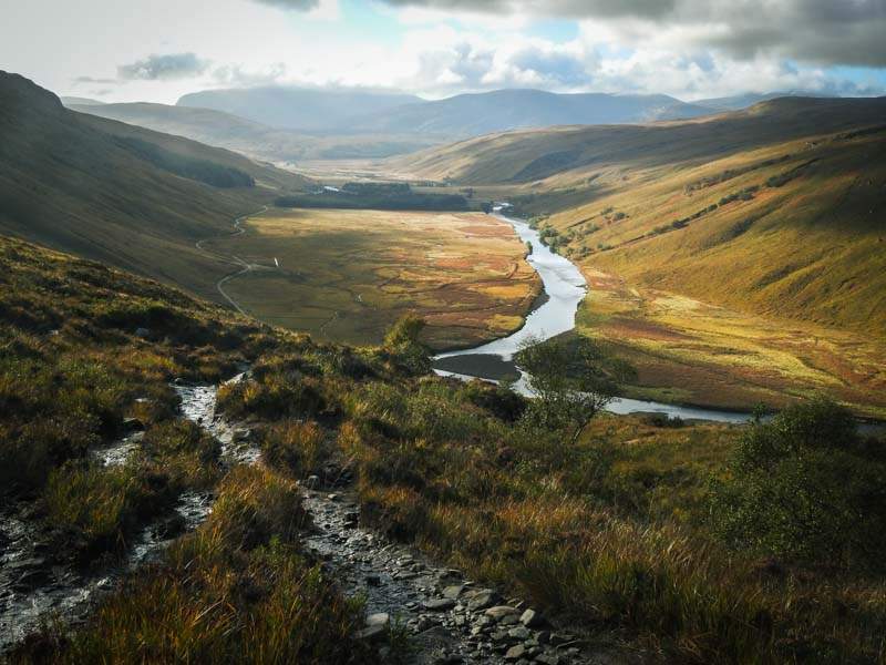
Once you do reach 150 m+ the views up Strath More to the south are worth it and if the weather is good enough you can almost see the summit. You can see the crags in the photo, but don’t worry the path takes you through these without the need to climb.
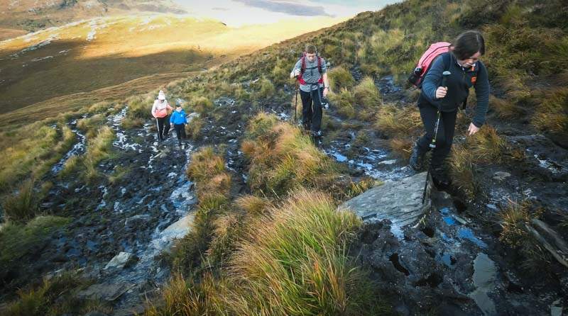
Does the path get better???
Not quite yet, it actually gets worse! You’ve reached and passed the rocky crags, now you’ll be at around 250 m+ mark where it does flatten out slightly. But for the next portion this is what you’ve got to look forward to…
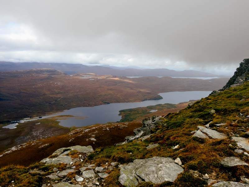
Not to worry though, it won’t be much further and the ground gets steeper and firms up, right until you reach around 400 m. After that it’s a gradual increase which is not to difficult and a slow and steady pace can easily be achieved. By now the views are getting much better with not only views of Strath More, but also of the hills behind Loch Hope.
Half way
You’ve gone through a fair range of firm, boggy, steep, rocky areas already – but you’re only half way seeing as you start at essentially see level. So from the 500 m mark, it’s a slightly steep climb and it’s pretty much the same gradient until the top. You will see a cairn along the path, but until you happen to be doing this in winter, you can’t miss a path up. Now the ground underneath if firm and good for walking, which you’ll be glad off. As with most hills are you near the summit the ground becomes much more stony, but as you’ll see from below it’s fine.
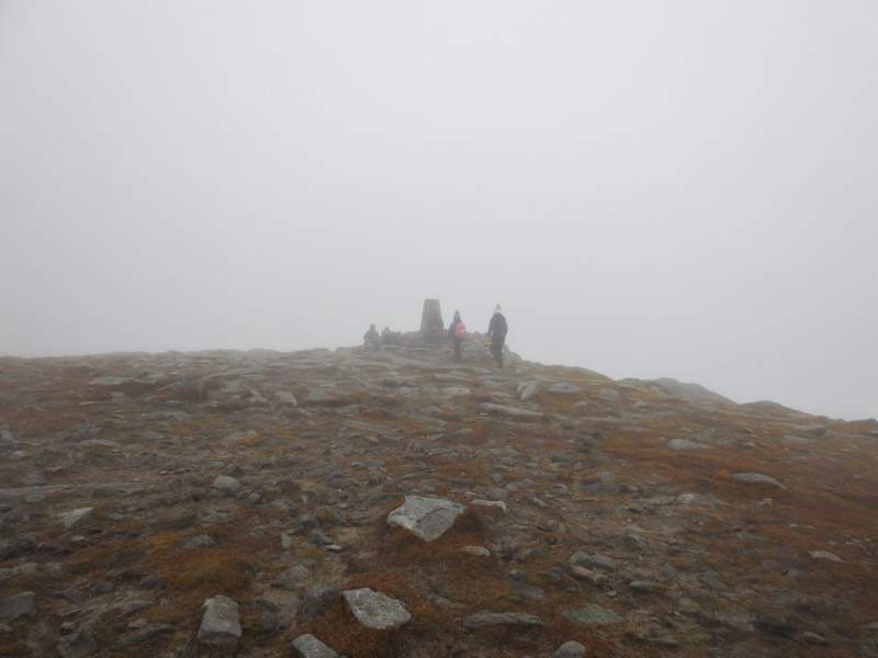
Finally there
The clouds were now surrounding us, almost clearing, but not quite. So with more than a little disappointment we reached the trig point. Stop for a bite to eat on the off chance that the clouds clear, but it wasn’t to be. Ben Hope had dashed out hopes, maybe another day. But not one I’ll be looking forward to.
Return
All that’s left to do is return the way you came. Yes through that boggy section as well. By the end of it you’ll be very glad to see your car.
Lastly – if time
Wish I’d seen this on the map earlier, as such we hadn’t planned to see it and as we came from the north we didn’t even pass it on the way. 😢
https://www.historicenvironment.scot/visit-a-place/places/dun-dornaigil-broch/
Check it out, you can’t beat a good broch. From what I’ve seen online, this one looks like a really good one. Do check it out.
Route Map