Beinn a’ Chochuill, will normally be climbed alongside Beinn Eunaich. These are two munro summits just north of Ben Cruachan and neither is particularly difficult. But in the short winter days when the weather and visibility aren’t great I hiked up and completed Beinn Eunaich. I was running out of time and weather was getting worse so I left Beinn a’ Chochuill for another day. You can see below this time I was lucky with the weather.
Walking Stats
- Height – 980 m
- Total ascent: 952 m
- My Time – 6 hours
- Distance –11.8 Km
- Season completed – Winter
- Difficulty – 3 / 10
- Weather – Perfectly clear, no wind till close to the summit. Snow level was around 850m
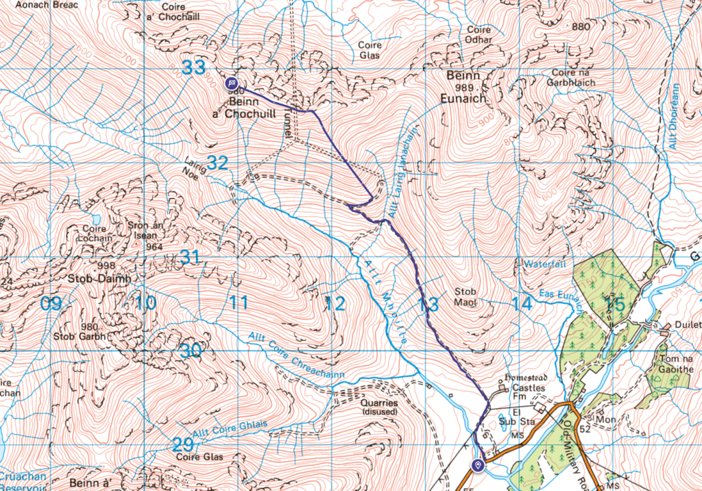
- See here for Route Map
- Just want to see the photos to get a feel for the hike – Flickr
If I include the time I did do Beinn Eunaich, this was my 3rd attempt to complete this munro! First time as mentioned time/daylight/weather wasn’t on my side. The second time, I had a day off and although I heard the wind was going to be bad the reports were constantly changing, so I went anyway. Didn’t even make it up the dirt road to reach the base of the hill as it was that windy!!! So third time lucky. As an aside, the wind really is the one weather element you can’t mess around with when hiking. Rain. cold, snow, sun etc can all be dealt with by gear and experience. Wind on the other hand will just pick you up!
Weather
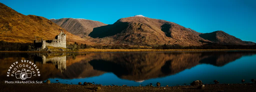
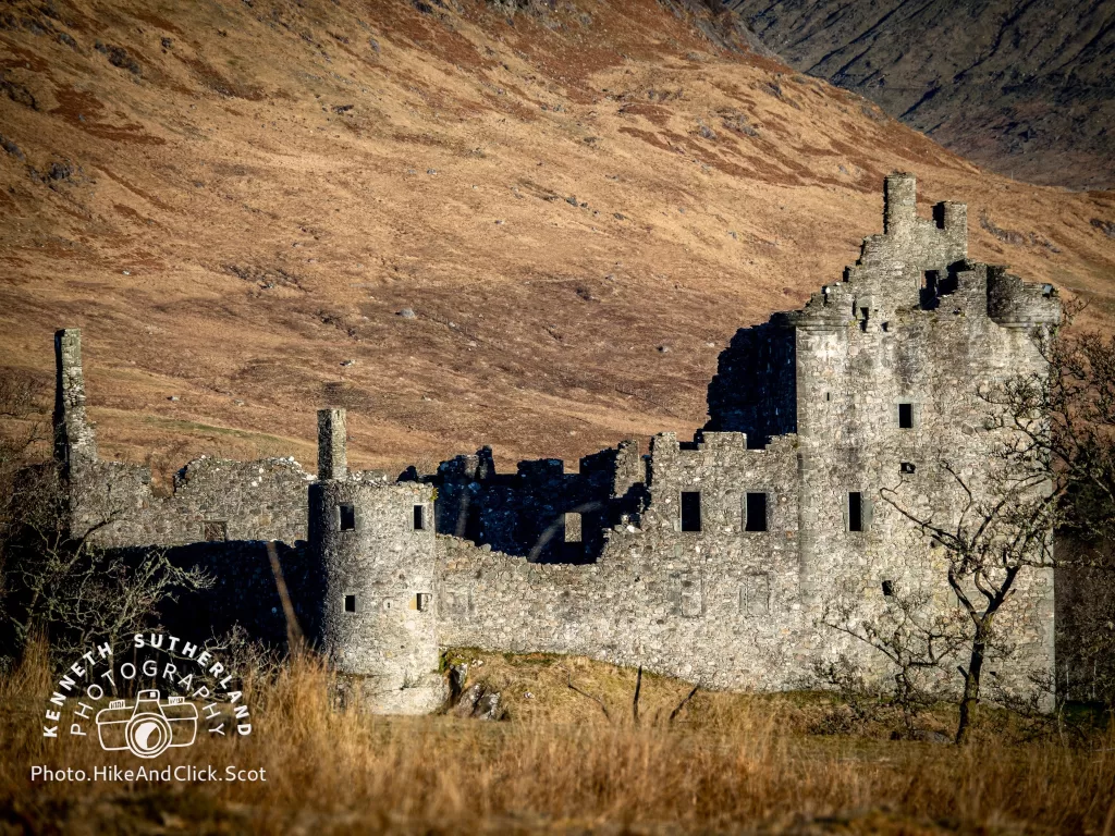
Whole of UK forecast for snow. North of Scotland was totally white, even the south of England had snow. Central belt had a little bit, which is obviously at low levels compared to a munro, so surely there much be fresh snow on the hills. Nope as you can see from this photo of Kilchurn Castle and the hills in the background – nothing. Well just a tiny bit at very high levels.
So certainly looked like I’d not require the ice axe and crampons – but I left them in/on my rucksack anyway, just in case. You just never know, that tiny part at the top with snow could have been solid ice. In the end it wasn’t. Just a layer of fairly thin snow and none of it was icy.
Cows
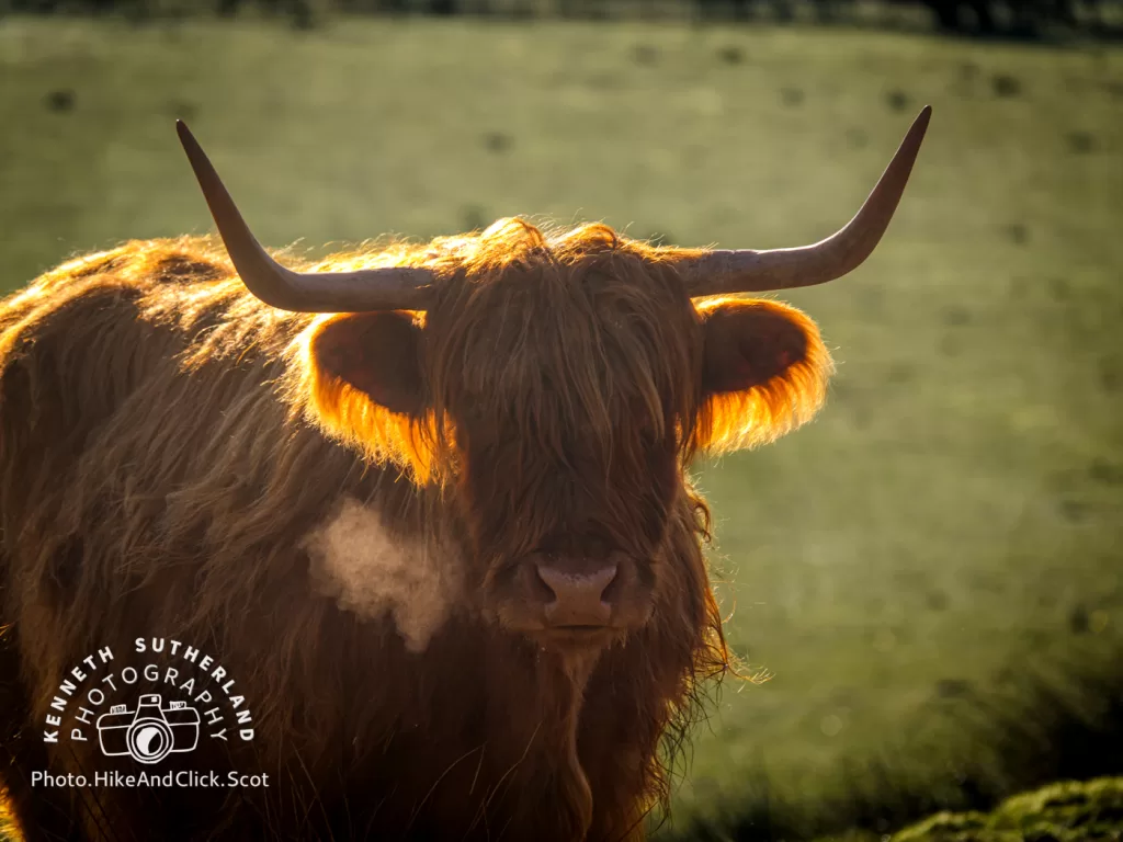
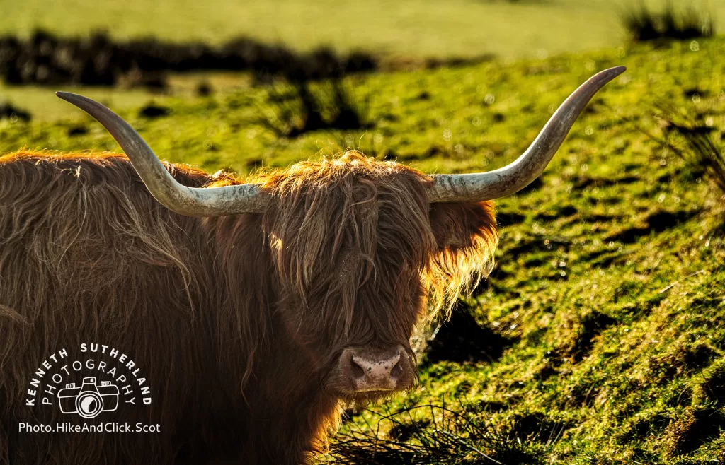
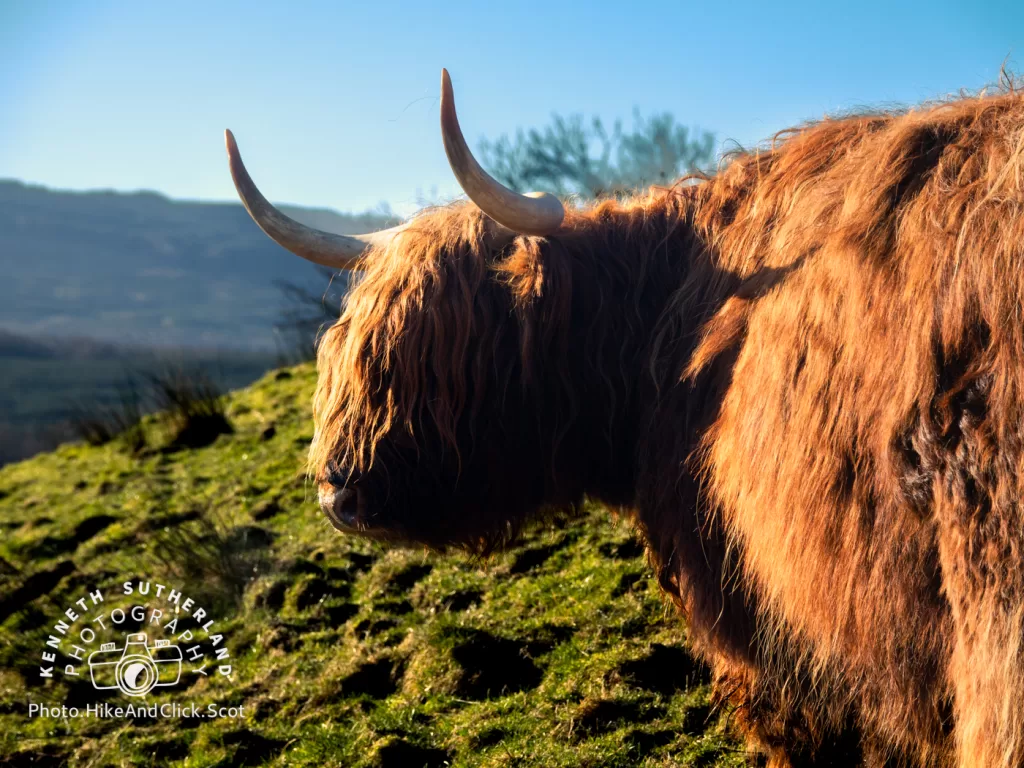
Each time I’ve come this way, there are always highland cows that you have to go past. If you aren’t sure about it – and I can see that for those that might be a bit unsure of cattle that it could be intimidating. Best thing to do it to take a wide berth. Odds are they will be either in the field by the road or at the edge feeding in some throughs. If they aren’t and they are in your way, then highland cows can be a bit stubborn! Taking a dim view on you trying to encourage them to shift over a bit 🙂
Heck you can come up behind them in a car and they won’t move for you! If they have calves with them, then I’d not go near them – otherwise not an issue (from my rather limited experience working in an auction mart and dealing with various animals for a couple of years. Disclaimer – if they attack you, then not my fault 😋!).
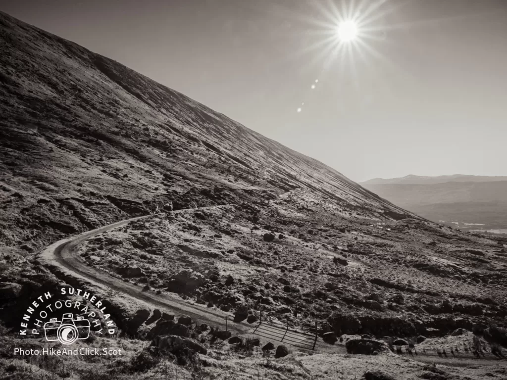
The path
So the first approx 3.5 Km is on a dirt track (the cows are just at the start of the incline) used for the various off road vehicles and as such not an issue for walking on. Towards the end, before you start the main climb from the base of Beinn a’ Chochuill it does dip down a little before rising semi steeply. Not that there is any scrambling etc, but it’s a 600m gain in roughly 1.5 Km. So just take it slow and steady.
When you reach the small bridge at the base, you can either start to head straight up, or follow the road a bit more and come back in on yourself (see the route map which shows the route via road as far as is possible). Once you do leave the dirt track, then there is a worn path of sorts. It’s a bit vague and certainly miss-able, but as long as you stick to the ridge you’ll be fine and you will then no doubt see the path in places.
Once at roughly 900m, there will be a small cairn which in bad weather will be helpful as it’s the split point if you are going to either go back down the same way, or carry on to Beinn Eunaich. From the cairn, you’ll follow ridge for another 3/4 Km and you are done.
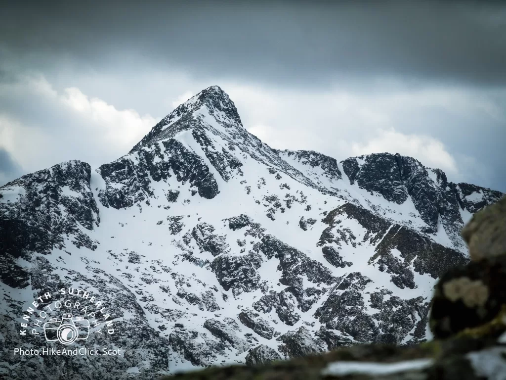
On a good day (I had great weather), the views of Ben Cruachan and Stob Daimh are magnificent. If you look west you can make out the Connel Bridge and the view to the north and east are a little on the bland side in comparison, but still lots of grand hills to feast your eyes on.
For me, I returned the same way so no surprises and what’s more the slope has enough seat sized boulders 😁 So why not take an occasional stop. It’s always amazing to just stop. Listen the complete silence of hills, perhaps an occasional raven or two, the rustle of a slight breeze but other than that – nothing. the views looking down onto Kilchurn Castle are quite beautiful.
Clothing
On my last hike I tested out for the first time some new Buffalo gear (read reviews here). This was their second outing and perhaps less of a test due to it being totally dry. So yet again as recommended I wore just the jacket on top and due to there being zero rain I didn’t bother to put my phone into a waterproof holder. Previously I was rather disappointment that the pouch wasn’t waterproof, but no rain, so no need to worry… After say half way, I took my phone out to check the time and it was rather wet! Obviously not rain, it was sweat!
So on one hand the special 6 jacket is very good at what it says it does, wicking away any sweat from your body. It clearly does a very good job, on the other hand that front pocket/pouch will keep nothing dry. It’s just a holder of items.
Route Map