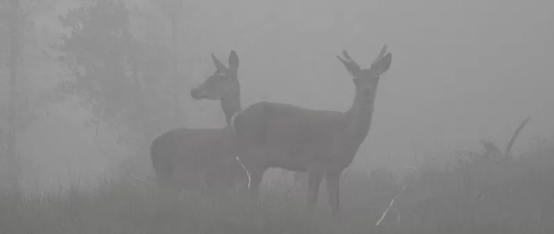
The summits of Lurg Mhor and Bidein a’Choire Sheasgaich are so remote that if you try and complete it without a bike then you will most likely require a tent. It has a huge lead in before you start to actually hike up a hill. It’s roughly 14 to 15 Km of track before you need to put your bike away (take note of GPS coords) and start to walk.
Overview
- Height – 987m and 945m (Lurg Mhor and Bidein a’Choire Sheasgaich)
- Total ascent: 1630m
- My Time – 12 hours
- Distance – 38.1 Km
- Season completed – Summer
- Difficulty – 3 / 10
- Weather – cloud cover generally down to around 500m, slightly variable at times. Very misty early in the day.
- Just want to see the photos for the hike – click here
- Route Map
The track
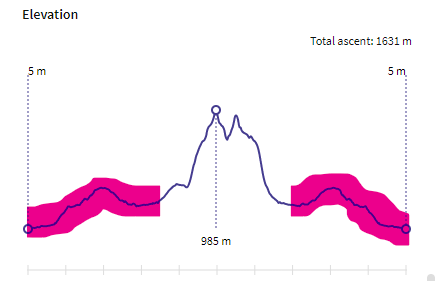
This is an elevation chart and I’ve highlighted the cycling portions.
With a combined out and in distance of around 29Km this part takes a seriously significant portion of the hike. There is a relatively high bump in that chart that you have to cycle up, only to drop back down again. Perhaps annoying, but then again – so much free wheeling and speed! Enjoy the speed – its murder on the legs for the reverse journey. As mentioned elsewhere in this site, I’m no cyclist so by the of the day that gradual and long incline wasn’t the easiest. With so many Km’s of going uphill I did end up walking with my bike a bit, but the track is good and without a bike you’re walking anyway.
Without a bike it would have taken a serious amount of time (hence the title of this post, you will most likely need to sleep over with one). The track itself as you’ll see from the photos is a perfectly good mountain/forest track and will pose no issues for the average mountain/off road bike. Make sure that if like me you don’t cycle much during the year to break in your seat/rear – otherwise you may be a tad sore come the end of the day! 😁
GPS your Bike
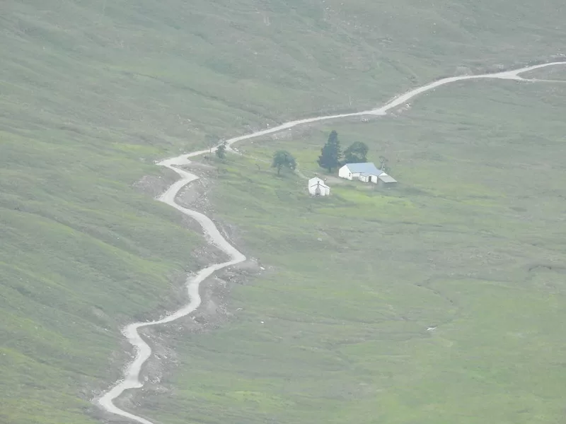
By the time you leave the track there isn’t anything notable to put your bike against. So no trees or fences or other immoveable objects. In this case I found somewhere just off the path and slightly out of sight. You will think, I’ll remember where it is, sure no problem. But can assure you that when the mist and clouds come down you will not remember or see it!
Best thing to do is to get your GPS out and take a photo of it’s coordinates. Then when you come down, should you not be able to spot it, then you can get your phone back out to check where you put it. I was almost at that point when I came to get my bike on this walk.
Route Map
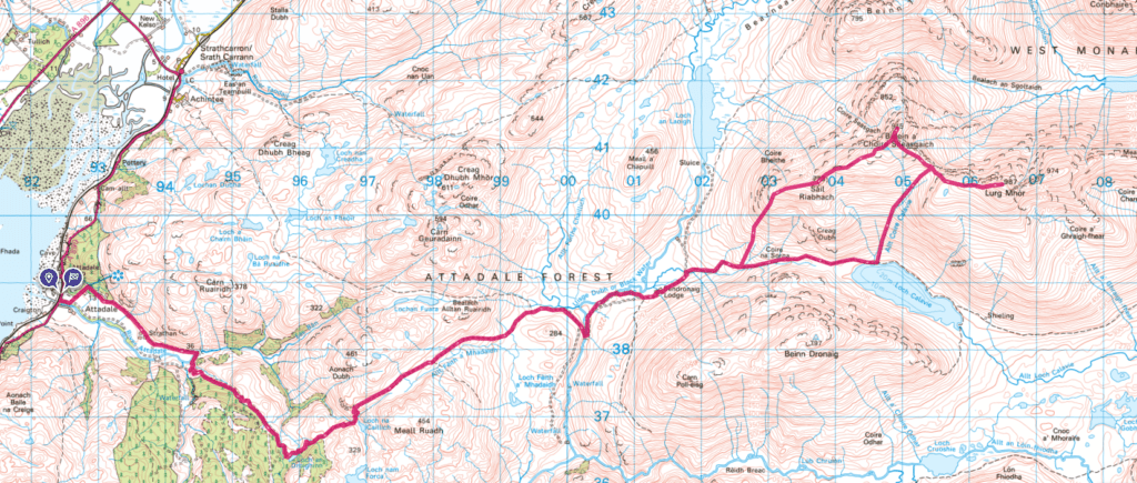
As you can see from the map – it’s a long way until you reach the fork, which is very close to where you’d leave your bike.
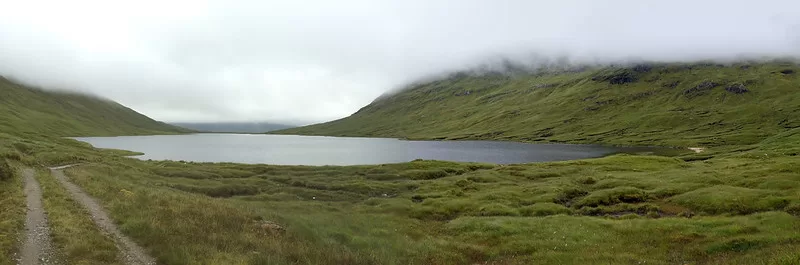
Once you have left your bike, the terrain is fine and on the whole it’s a grassy set of hills. You’ll head up slightly and head towards Loch Calavie. The track here is obvious and clear. After a short distance of walking with the loch on your right hand side, you’ll head on up a reasonable steep and consistent gradient for roughly 200-250m. Carry on until until you reach around 600m in elevation. After that the slope isn’t so strenuous. Keep on going further still until you can go no further (without dropping down) and if you are lucky you’ll get magnificent views over Morar Forests (not actually a forest…).
From there head right (east) up the path. This small section is a little on the steep side, but it soon levels off again before climbing for the last time to 987m and the summit of Lurg Mhor. The surface from around 750-800m does start to become much more rocky, but it’s not a crappy boulder-field, so going isn’t too slow.
Reverse a bit
Follow the path back down to where you turned east to head up, and then carry on. There is a path (worn out track), but it wasn’t the most distinct path. But there is a old stone dyke, or at least the remains of one. You can use this as a marker to follow should the weather be terrible.
Looking up at Bidein a’Choire Sheasgaich from a far may seem a little daunting but the closer you get the more you realise that you can make out the worn out track. The gradient is fairly steady and as you climb the ground does become slightly rockier. But still enough grass around and steady path that you don’t really notice too much.
Before you know it, you are at the top. taking in the view and probably a few selfie photos, all going well! It’s a slightly smaller summit at 945m, but if the weather is kind, you’ll feel like the views are much better.
Back to the path
Now head down by retracing your steps for a very small amount, before heading in a roughly south westerly (more west than south) direction. You’ll quickly see a small lochan and after that follow a fairly pathless ridge walk downhill. As you come to the end of the ridge you will now want to change direction to avoid going down too steeply. At this point, unless the weather is really crap, the main path/road will be easily visible, if not then head SW rather than WSW direction you would have been currently taking.
Find your bike…
All there is to do now is find your bike! I was sure I knew where I put mine, and as I approached the area could I see it? Nope, Walked on a bit more, but you get that Oh no feeling, where did I put it. Thankfully I did see it; and even if I didn’t I had taken a photo of my GPS device close to where I put it. Still doesn’t stop you thinking – WHERE IS IT!
On your bike. It’s a slow and gradual incline, which I found very sapping of energy on the legs. I did have to walk a bit with my bike! Soon enough it will end and you’ll be back on a downward track and able to fully enjoy the ease of having taken your bike.
Ultimately unless you are the type of person that runs up and down hills regularly then this is a bike hike or you take enough stuff with you for an overnight stay. If remoteness is your goal, then this certainly ticks that box.