Looking for solitude, then this is not for you. Looking for a hill close to the central belt with some outstanding views while being able to be back in time for a late lunch then this will do nicely.
- Height – 974 m
- Total ascent: 1009 m
- My Time – 7 hours
- Distance – 11.6 Km
- Season completed – Autumn
- Difficulty – 2 / 10
- Weather – Clear, crisp air. Starting to freeze from 600m up. Clouds very high.
- Just want to see the photos to get a feel for the hike – click here
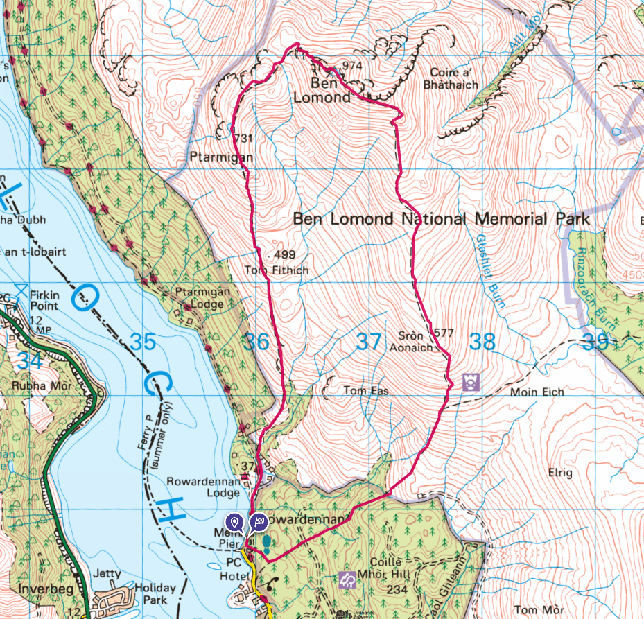
- Route Map
First Munro
For many this will be your first murno, it’s so close to the central belt and Glasgow. It’s one of the easier hills and depending on the route you take, you can make it even simpler than the route I took. Not that my way was in any way difficult, but if you want something very straightforward then you’ve options. Also as it’s a simple and quick hike, then this can also be a great munro to do in winter – with the bonus of being on it when it’s a little bit quieter!
Normally I’ll put the map at the bottom of my posts, but for this to explain what I mean here is the route I took.
Route Map
Choices
Now that you can see it’s a circular route, which of course means you don’t have the boring same return journey. But should this be your first munro and you aren’t sure of what’s ahead then the simplest way up and down would be the most easterly path up and down.
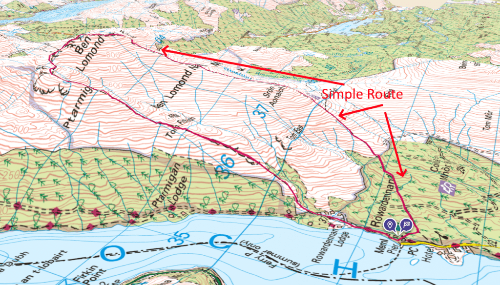
From the 3D image you can perhaps see that the north section from the summit is a bit steeper than coming at it from the south. Should you wish to do this (the slightly easier route), then after parking your car then you’d head south which meant going through/passed the building that contains the toilets. From there you’ll see the path that goes through the forest. Once on the path it’s plain sailing all the way.
For me, I headed north, as in roughly the same direction that you would drive into the car park.
Starting point
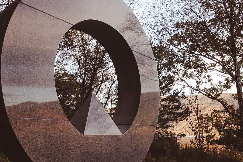
As mentioned I took the circular route, and if you do the one of the first things you’ll pass is the war memorial as you leave the car parking area. A beautiful wee monument.
As you progress the ground is firm and the path is very clear. Taking this route there is virtually nowhere that the path isn’t obvious. You could get away with strong trainers rather than boots – although there are parts of the path that depending on the weather could get your feet wet if you don’t have hiking boots.
If you don’t have hiking boots and wish to try out a hike without the cost of buying boots, then the simple route going up and down the same way will be your best option. As in take the path south from the car park then up the easterly route.
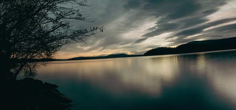
Views
In terms of a route description there isn’t much to say, but the views will hopefully speak for themselves. The path at the start is a standard hiking path, not super wide, but wide enough. It’s solid enough in its construction so it isn’t boggy. It weaves through some trees at the start (you’ll see a sign saying Ptarmigan path) before thinning out as you go up. Before you know it, you’ve gained a reasonable height for brilliant views overlooking Loch Lomond the trees are well behind you.

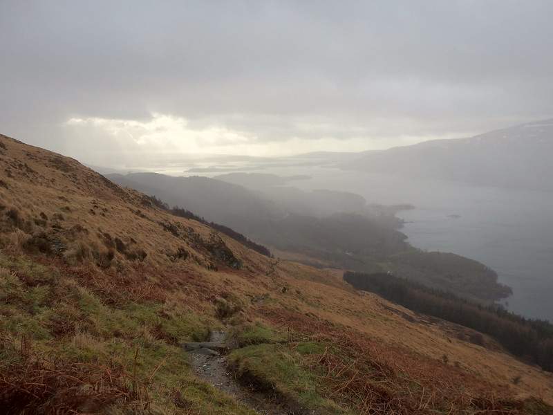
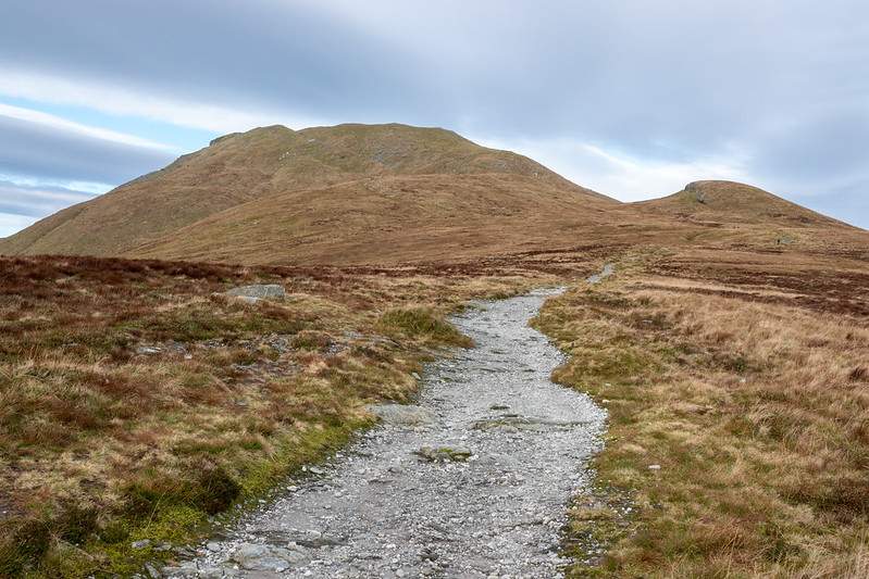
This is the sort of path that it’s like once you leave the forested section. As you can see a fairly standard hill path. With Loch Lomond on one side the Ben Lomond on the other.
I’ve been here before
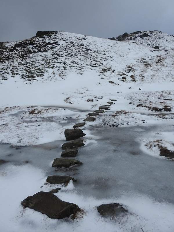
Now you will eventually reach a lower summit, the Ptarmigan summit at 731m. This part levels of and depending on the wind direction can be extremely windy. I went to do Ben Lomond before, but under winter conditions. I reach here no problem and the wind didn’t even feel that bad. But just around and after the stepping stones I was literally picked up by the wind. It really was just the direction the wind was coming from and that it was being funnelled between the two ridges running south to north.
So as always be careful. After I was picked up, I turned around. I seen others that passed me, then also turned around. Wind is bad enough, but that plus the icy underneath – less than ideal walking conditions.
But it’s Autumn now
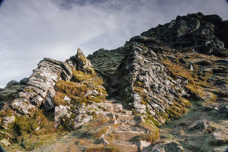
Nearing the top now, and it’s getting reasonably steep as well. You’ll come across the cool gateway looking rock formation. After that it’s just a steep climb to the top.
Simple return journey
The return trip is a bit boring in comparison to the walk up. Just a wide path with more than a few hikers and bikers going up and down. This path is super wide and is the main route for most people going up and down Ben Lomond.
Finally you’ll reach the forested section and back to the car park. There is a cross roads path in the forest – but it’s well sign posted and depending on the car park used, will most likely be a carry straight on job.