- Ascent – 1009m
- Height – 926 m highest point
- My Time – 7 hours
- Season completed – Summer
- Difficulty – 2 / 10
- Weather – Calm, sunny, pleasantly warm. Low cloud right as I reached the summit!
- Just want to see the photos to get a feel for the hike – click here
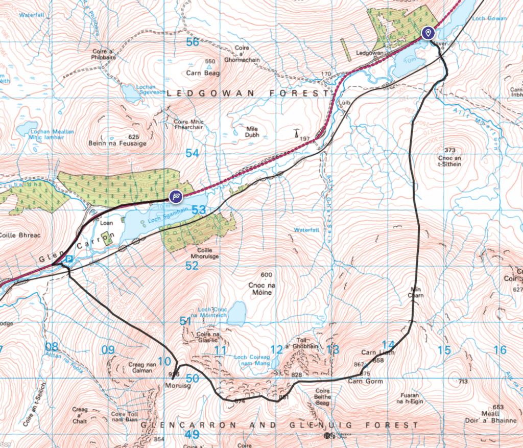
- Route Map
Yet again, my attention to details at the start have a lot to be desired.
TLDR
The route taken – although not intended, I’m very glad I took it. If I’d planned it then I’d have taken a bike, dropped it off at one car park, then driven to the other to start the walk. So a great route that means you don’t need to double back on yourself, but it helps if it’s one that you planned!
Stop and think before you start!
I do this more often than I’d like to, and each time I start a hike I think yeah this is it – just get going. Do I check I am where I think I am, do I spend that 2 mins just to make sure the start is good. Well sometimes I do and sometimes I don’t. I didn’t with this one.
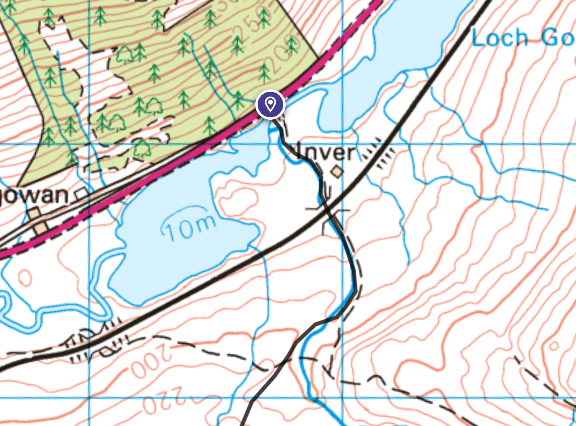
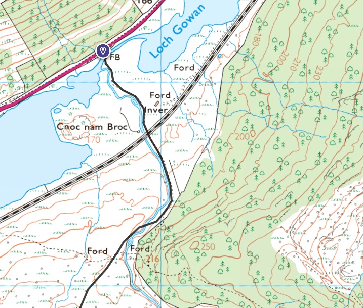
My mistake was that I didn’t match up the OS map grid coordinates with the correct place on google maps for the car park. So if you look at the map at the bottom of this post you’ll see the car park on the left of the map. This is where I should have (or at least planned to) started.
Realisation
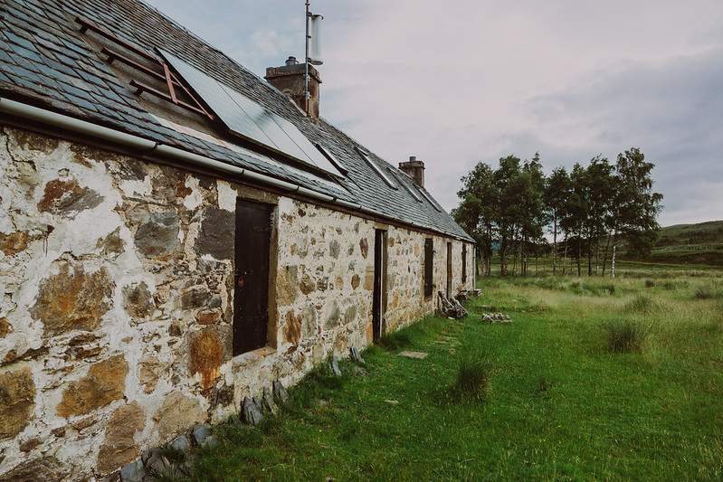
Anyway, off I trot with my gear on, map to hand. Weather is good enough not to require the map, and there is only one option for a path so I head straight on. A small croft house sits near the start for a few photos. Cross the railway just as the guide I read had said… and then I’m met with a forest???
Hmmm that’s not on the map. But it’s fairly common to view an OS map at 1:50K and it won’t have a forest, but at 1:25K and it does! Pretty annoying really. I don’t think anything off it, as I’d printed the map at 1:50K, and I could see the summit in the distance. Although in the back of my head I was thinking I was expecting it to be more in front of me and not to the right side.
Still I carry on, going by sight, yet the more I walked the more that niggle in my head was like, something just isn’t right! Now I get the map out (but I hadn’t printed out the area where I started, as where I did start wasn’t where I meant to). None of the features match up with what’s around me. Get the GPS unit out – ahhhh!!! I’m off my map. So I get the phone out seeing as I downloaded the map on it + plus extra.
Carry on or turn back?
So I had a deadline, in that if I wanted food at the hotel where the campsite was located that I was due to stay at I had to be there by a certain time. Otherwise I would be having porridge or similar for dinner.
If I turned back, I’d have lost an hour, maybe a bit more. That would then put the expected walk time quite close to my deadline to be off the hill. I didn’t want to rush it. I could just walk, see how far I got and turn back if time didn’t allow – but that seems like a crap option.
Or I could go up, do the munro, not do the corbet of Sgùrr nan Ceannaichean (which was the original plan) and head back down to the intended start point. But that road back to the start was I estimated around 8 Km. That would take a fair bit of time, even if it was flat.
In the end I chose to carry on, and hope that when I reached the road I could be quick or maybe even hitch a lift!
The hill/route itself
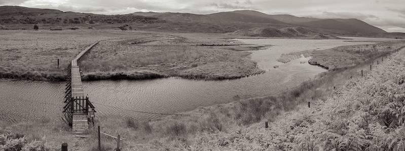
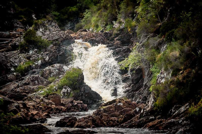
Starting at the car park near Inver croft, right in the middle of Loch Gowan there is a boardwalk through the marshes to the croft house. Follow the path over the railway (through the gates), then up to the start of the forest area. Don’t enter the forest, but cross over the stream.
It’s marked as boggy on the maps, but it’s not that bad. Maybe a lowly 2 or 3 out of 10 bog factor. At no point here did my boots get muddy. Perhaps if their had been heavy rain, but for me it was fine.
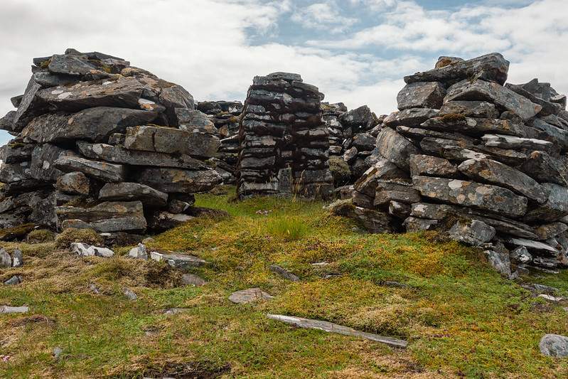
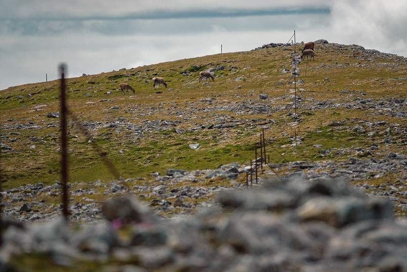
Carry on in a south direction round the western side of Cnoc an t-Sithein. Essentially, just keep going south, gaining altitude. Then you eventually see old metal fence posts/marks. These follow the ridge in the hill, which is now going up in a south west direction. There are no steep drops or places to watch out for. Near the top of Carn Liath there is a well built structure should you need it due to the weather. Carry on a little further and you’ve now done Carn Gorm at 875 m.
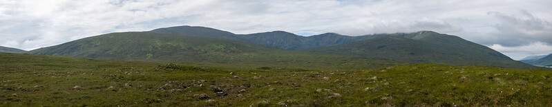
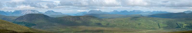
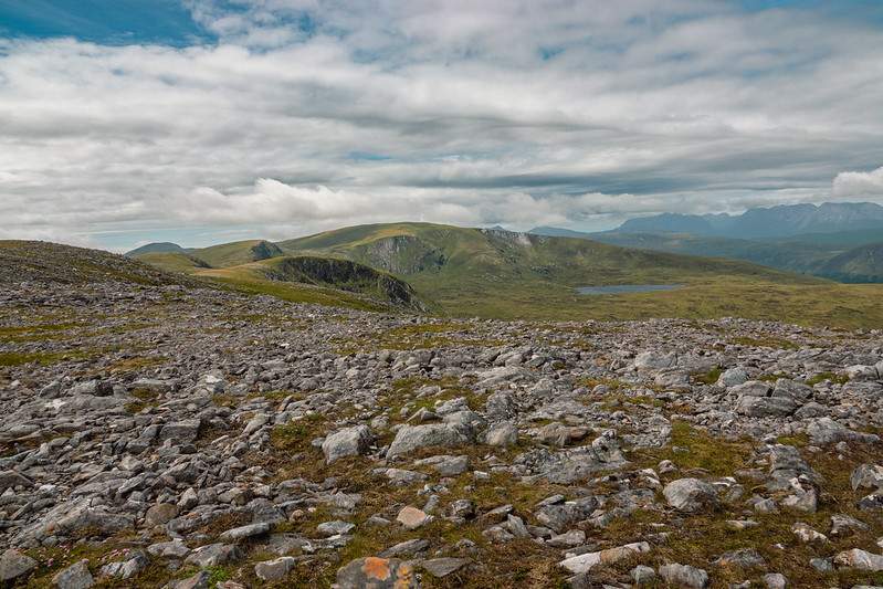
You will get great views south looking at Maoile Lunndaidh and a range of other hills in the Monar area.
Undulating route
The route is smooth, up and down and goes something like this from Carn Gorm. 875 m -> 790 -> 828 -> 800 -> 851 -> 790 -> 872 -> 800 -> 926 m.
One portion is mildly rocky (portion after the 872 m peak, unnamed), and should pose no issue to anyone, but you could avoid it by either walking around that peak or heading south once on it.
Eventually you’ll reach the summit of Moruisg. Their are some small cairns along its flat top where you can get minimal shelter to stop for some food. Then you head straight down. Head down from the easterly side of the summit. There is a path, but it’s not clear and at points it disappears. If going down and it disappears, stick to the left of the boggy section and you’ll then pick it back up once out of the bog area.
It’s reasonable steep between 700 and 500 m. If the weather is good you’ll be able to see the gate and the car park in a roughly north westerly direction. So even if you can’t see the path, it’s simple to head in that general direction. The worst portion of the walk is near the car park as that area will have the most concentrated footfall – so it’s really boggy!
Did you plan to be here?
So now you’re at the car park – if you’ve read this and planned this route, then great you’ll have a bike to cycle the relatively flat and wide road back to your car. If like me, you didn’t have a bike, you need to walk…
So I walked and stuck my thumb out at passing cars. I’ve not hiked since I was a teenager! Lots of cars passed me, I was wondering do people still hitchhike? Will any stop, will I get back to my car in time to make it to the hotel…?
Well, thankfully for me a lovely couple from Czech Republic stopped and gave me a lift which saved me an hour or so of a walk. Absolutely brilliant, so kind 😎 They had come back from a tour/holiday around Skye before heading up to Inverness.
Route Map